Sea Surface Height & Altimeter [2025.01.08]
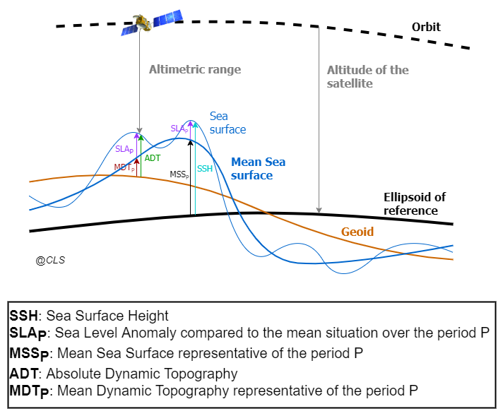
Gridded and along-track sea surface height (SSH) products from satellite altimetry, distributed by CMEMS, C3S and AVISO.
CMEMS gridded products (L4)
-
Two-Satellite (Climate) · 0.25° · 1993-01-01 – 2024-11-19
Stable two-satellite series for climate studies. Dates retrieved on 2025.08.14
-
All-Satellite, Multi-Year · 0.125° · 1993-01-01 – 2024-11-19
Multimission altimeter SSH in delayed time. Dates retrieved on 2025.08.14
-
All-Satellite, NRT · 0.125° and 0.25° · 2022-10-04 – present
Near-real-time multimission SSH. Dates retrieved on 2025.08.14
Earlier split of the Multi-Year series
Until the 2024.12.26 retrieval the series was split into MY (1993 to 2023-06-07) and MYINT (Multi-Year Interim, 2023-06-08 to 2023-12-31). The current product covers 1993-01-01 to 2024-11-19 in one series.
CMEMS along-track product (L3)
SEALEVEL_GLO_PHY_L3_MY_008_062 · 7 × 7 km (1 Hz) · daily · 1993-01-01 – 2024-04-11 (retrieved 2025.01.08)
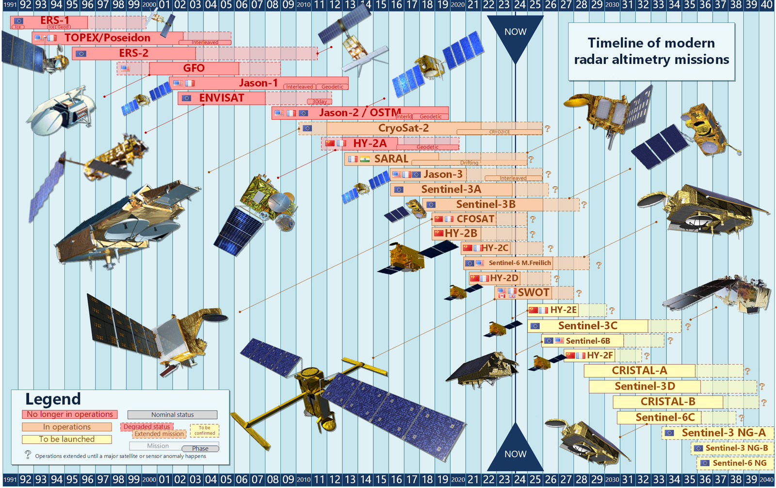
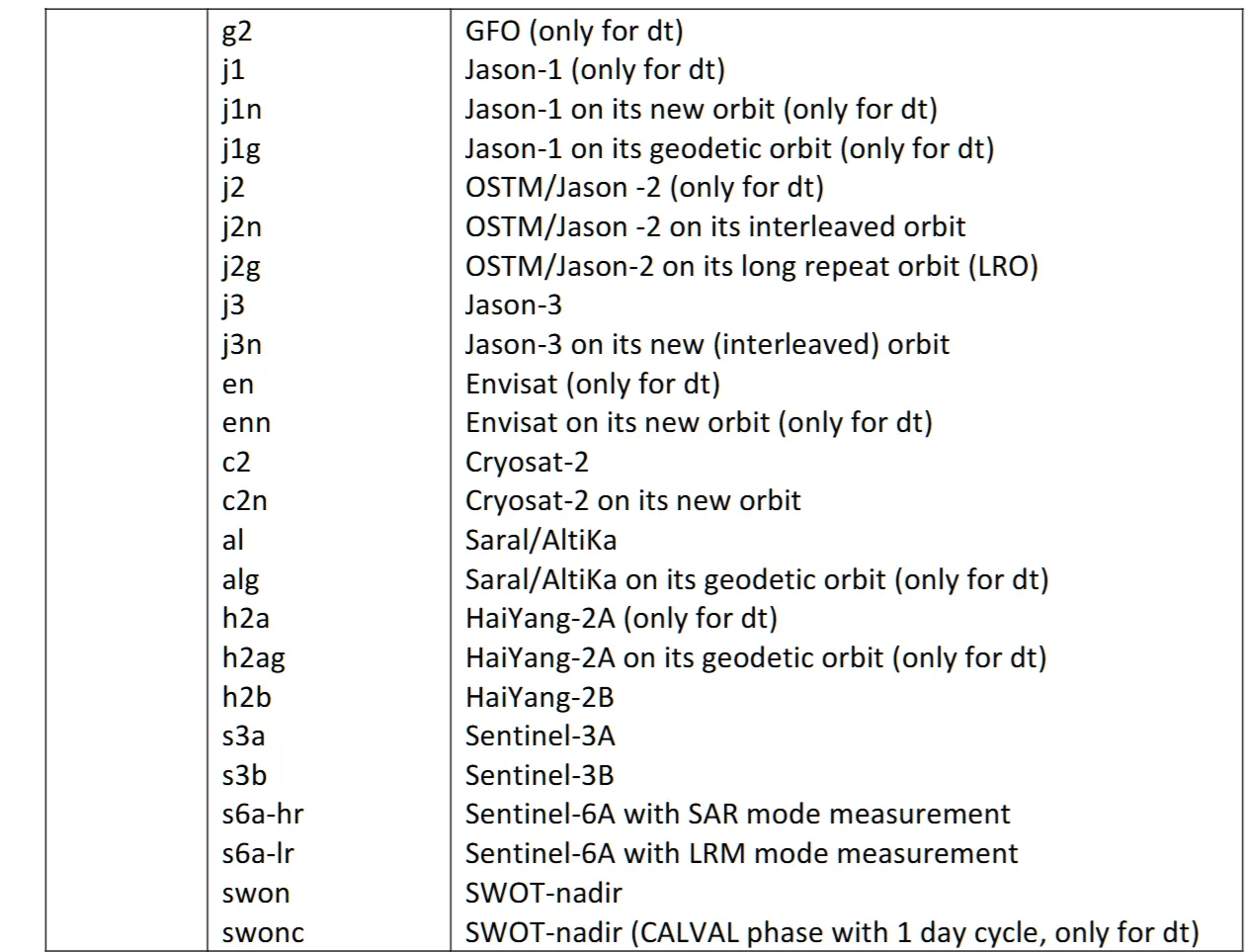
Along-track sea level anomalies (SLA) computed with respect to the 1993–2012 mean at a 1 Hz (about 7 km) sampling, for delayed-time applications. Processed by the DUACS multimission system from all available altimeter missions (Sentinel-6A, Jason-3, Sentinel-3A/B, Saral/AltiKa, Cryosat-2, Jason-1/2, Topex/Poseidon, ERS-1/2, Envisat, Geosat Follow-On, HY-2A/B, and others).
Variables
| Variable | Unit | Description |
|---|---|---|
sla_unfiltered |
m | Sea level anomaly, not filtered, not subsampled, with DAC, ocean tide and LWE corrections applied |
sla_filtered |
m | Sea level anomaly, filtered, not subsampled, with DAC, ocean tide and LWE corrections applied |
mdt |
m | Mean dynamic topography (sea surface height above geoid) |
dac |
m | Dynamic atmospheric correction |
ocean_tide |
m | Ocean tide model |
internal_tide |
m | Internal tide signal: coherent M2, K1, O1, S2 modes |
lwe |
m | Long wavelength error |
time |
Time of measurement | |
longitude, latitude |
degrees | Theoretical position for repetitive orbits |
flag |
0, 1 | Data origin |
cycle, track |
Cycle and track the measurement belongs to |
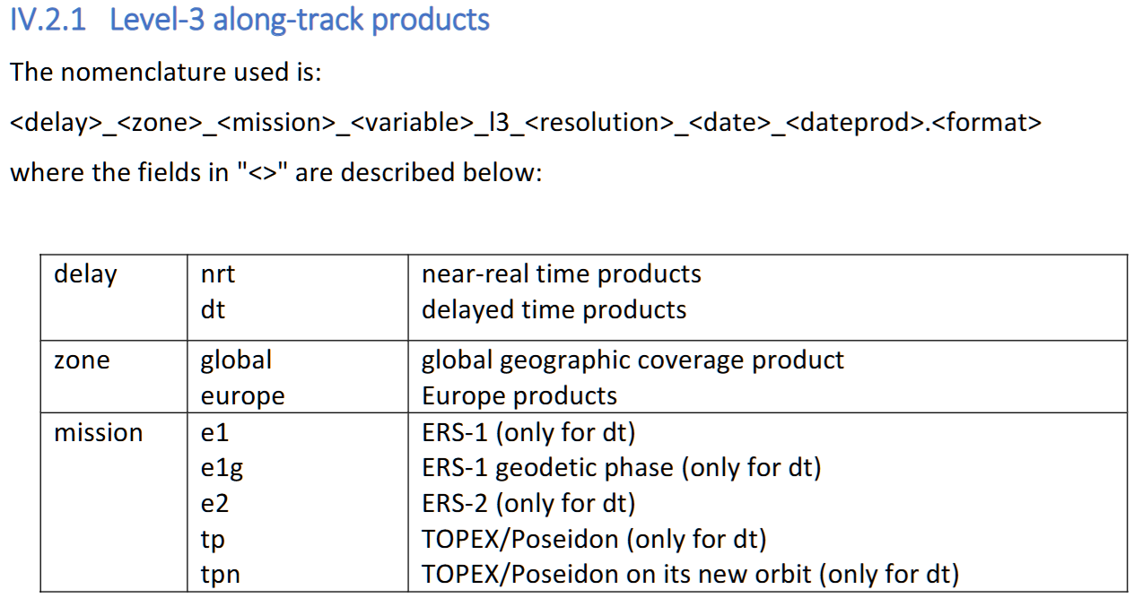
Level-3 along-track products
AVISO
The Copernicus Marine Service (CMEMS) processes and distributes the Ssalto/Duacs gridded allsat series and along-track sea level anomalies, absolute dynamic topographies and geostrophic velocities over the global ocean and regional seas, in delayed time and near real time. The Copernicus Climate Change Service (C3S) processes and distributes the Ssalto/Duacs delayed-time twosat series over the global ocean, Mediterranean Sea and Black Sea.
Along-track L2P download (Sentinel-3, Sentinel-6A)
The Sentinel-3 and Sentinel-6A (Jason-CS) L2P products are available from EUMETSAT via EUMETCast and from AVISO+:
- Register on the AVISO+ portal, sign the license agreement and select the product "Sea Level Anomalies Along-track Level-2+ (L2P) Sentinel-3&6". A login and password arrive by e-mail.
- Once registered, access is given in your personal MY AVISO+ account on the product page (authenticated FTP, online products).
- Archived Sentinel-3 products: register and download at the AVISO+ CNES Data Center.
- NRT/STC products via EUMETCast and the Data Store (S3 and S6); S6 and S3 NTC products via the Data Centre.
Climate Data Store
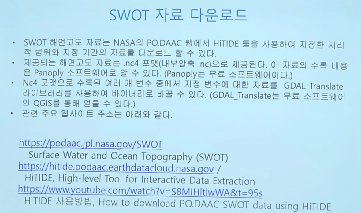
SWOT