Mixed Layer Depth [2025.03.22]
Mixed layer depth (MLD) datasets and toolboxes for computing MLD yourself.
Climatology & observation-based
World Ocean Atlas 2018 MLD
1° and 1/4°
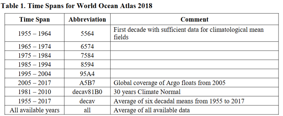
Annual, seasonal, monthly. Provided only for two time spans: A5B7 (2005–2017) and decav81B0 (1981–2010)
WOA18 MLD netCDF
WOA (Atlas & Climatology)
What the WOA18 MLD folder names mean
The download link contains two folders with somewhat unusual names. Their meaning is as follows.
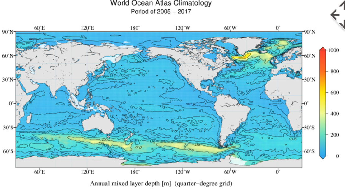
Mixed Layer Depth fields are available on one-degree and quarter-degree grids, annual, seasonal, and monthly, ONLY for A5B7 (Time Span: 2005~2017) and decav81B0 (Time Span: 1981~2010) time spans.
MIMOC
1/2°, Argo
Argo product 2. Gridded isopycnal and mixed-layer water properties (objective mapping with front-finding and bathymetry-following algorithms)
LOPS MLD Climatology (de Boyer Montégut)
Introduces several MLD references. Global climatology with a density threshold of 0.03 kg/m³ relative to 5 m
Surface Mixed Layer Depth (Ifremer)
MLD climatology, 0.03 kg/m³ criterion (SEANOE)
GOSML
Monthly statistical climatology
A Global Ocean Surface Mixed Layer Statistical Monthly Climatology (NOAA PMEL)
MLD in Polar Regions
Model & reanalysis
GLORYS12V1 (CMEMS)
Variable mlotst (Ocean Mixed Layer Thickness)
MLD toolboxes
Toolbox 2
Subjective method (MATLAB)
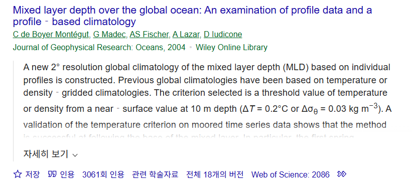
The original paper it cites (de Boyer Montégut et al., 2004) has more than 3,000 citations. Note that the toolbox was not written by the paper's authors
File Exchange: compute MLD based on subjective method
de Boyer Montégut et al. (2004), JGR Oceans