Typhoon & Hurricane [2024.12.04]
Typhoon and hurricane best tracks, satellite imagery, and field observations.
Best track
-
IBTrACS (NOAA NCEI)
International Best Track Archive for Climate Stewardship. Merged best tracks from multiple agencies
-
JTWC (U.S. Joint Typhoon Warning Center)
Joint Typhoon Warning Center, Western Pacific
-
KMA (Korea Meteorological Administration)
Typhoon data from the KMA Open MET Data Portal
-
JMA (Japan Meteorological Agency)
RSMC Tokyo best track data
MATLAB: read the USA-agency fields from IBTrACS
%% Read TYPHOON data (USA data)

clc; clear; close all;

% recommend to use "\\" not "\" in file path.
fnm = "C:\\Users\\MATLAB\\Typhoon_IBTrACS.WP.v04r00.nc";

soulik = load_typhoon_data(fnm, 'SOULIK', 2018);
rumbia = load_typhoon_data(fnm, 'RUMBIA', 2018);

save("Typhoon_YS_2018.mat", "soulik","rumbia")


% FUNCTION ================================================================
function tph = load_typhoon_data(fnm, typhoon_name, typhoon_year)
tph = struct;

tname = deblank(string(ncread(fnm, 'name')'));
time = datetime(1858,11,17,00,00,00) + days(ncread(fnm, 'time'));

% indexing
idname = strcmp(tname, typhoon_name);
idyear = year(time(1,:)) == typhoon_year;
% nameid_noname = strcmp(tname, 'NOT_NAMED');  % except 'no-name'

idtyphoon = find(all([idname,idyear'], 2));

% you could modify the variable list below.
usa_lat = ncread(fnm, 'usa_lat');
usa_lon = ncread(fnm, 'usa_lon');
usa_status = reshape(string(reshape(ncread(fnm, 'usa_status'), 2, [], 1)'), 360,[]);
usa_wind = ncread(fnm, 'usa_wind');
usa_pres = ncread(fnm, 'usa_pres');
usa_sshs = ncread(fnm, 'usa_sshs');
usa_r34 = ncread(fnm, 'usa_r34');
usa_r50 = ncread(fnm, 'usa_r50');
usa_r64 = ncread(fnm, 'usa_r64');

% tnum = ncread(fnm, 'number');
% tusa_agency = ncread(fnm, 'usa_agency');
% tusa_atcf_id = ncread(fnm, 'usa_atcf_id');
% tusa_record = squeeze(ncread(fnm, 'usa_record'));
% tusa_poci = ncread(fnm, 'usa_poci');
% tusa_roci = ncread(fnm, 'usa_roci');
% tusa_rmw = ncread(fnm, 'usa_rmw');
% tusa_eye = ncread(fnm, 'usa_eye');
% tusa_gust = ncread(fnm, 'usa_gust');
% tusa_seahgt = ncread(fnm, 'usa_seahgt');
% tusa_searad = ncread(fnm, 'usa_searad');

tph.time = time(:,idtyphoon);
tph.lat = usa_lat(:,idtyphoon);
tph.lon = usa_lon(:,idtyphoon);
tph.status = usa_status(:,idtyphoon);
tph.wind = usa_wind(:,idtyphoon);
tph.pres = usa_pres(:,idtyphoon);
tph.sshs = usa_sshs(:,idtyphoon);
tph.r34 = usa_r34(:,:,idtyphoon);
tph.r50 = usa_r50(:,:,idtyphoon);
tph.r64 = usa_r64(:,:,idtyphoon);
end
IBTrACS (WP v04r00) USA-agency variables (summary of MATLAB ncdisp output)
| Variable | Dimensions | Description | Units |
|---|---|---|---|
number |
storm | Storm number (within season) | 1 |
name |
char128, storm | Name of system (may combine names from different agencies) | |
time |
date_time, storm | Nominally 3-hourly; extra positions near landfall, max intensity, etc. | days since 1858-11-17 00:00:00 |
usa_agency |
char32, date_time, storm | Source dataset for U.S. data | |
usa_atcf_id |
char32, date_time, storm | ATCF ID for the storm | |
usa_lat, usa_lon |
date_time, storm | Latitude / Longitude (U.S. Agency) | degrees_north / degrees_east |
usa_record |
char1, date_time, storm | Storm record type (C, G, I, L, P, R, S, T, W) | |
usa_status |
char2, date_time, storm | Storm status (TD, TS, TY, ST, HU, EX, etc.) | |
usa_wind |
date_time, storm | Maximum sustained wind speed | kts |
usa_pres |
date_time, storm | Minimum central pressure | mb |
usa_sshs |
date_time, storm | Saffir-Simpson Hurricane Wind Scale category (-5 to 5) | 1 |
usa_r34, usa_r50, usa_r64 |
quadrant, date_time, storm | Radius of 34 / 50 / 64 knot winds | nmile |
usa_poci |
date_time, storm | Pressure of outermost closed isobar (not best tracked) | mb |
usa_roci |
date_time, storm | Radius of outermost closed isobar (not best tracked) | nmile |
usa_rmw |
date_time, storm | Radius of maximum winds (not best tracked) | nmile |
usa_eye |
date_time, storm | Eye diameter (not best tracked) | nmile |
usa_gust |
date_time, storm | Maximum reported wind gust from a US agency | kts |
usa_seahgt |
date_time, storm | Wave height for given radii | ft |
usa_searad |
quadrant, date_time, storm | Radial extent of given sea height | nmile |
usa_record: C – Closest approach to a coast, not followed by a landfall · G – Genesis ·
I – An intensity peak in terms of both pressure and wind · L – Landfall · P – Minimum in central pressure ·
R – Additional detail on intensity during rapid changes · S – Change of status · T – Additional detail on the track ·
W – Maximum sustained wind speed
usa_status: DB disturbance, TD tropical depression, TS tropical storm, TY typhoon, ST super typhoon,
TC tropical cyclone, HU/HR hurricane, SD subtropical depression, SS subtropical storm, EX extratropical,
PT post tropical, IN inland, DS dissipating, LO low, WV tropical wave, ET extrapolated, MD monsoon depression, XX unknown
Satellite
-
CIRA Satellite Library
Tropical cyclone satellite imagery library (Colorado State Univ.)
CIRA satellite imagery example (Typhoon Khanun) -
IFREMER CyclObs
Ocean surface wind speed estimated from L-band radiometers and C-band SAR
-
NHC / CPHC Satellite
Satellite imagery from the National Hurricane Center and Central Pacific Hurricane Center
How to cite CyclObs data
If you have to use SAR images from CyclObs, please be sure to credit Ifremer. Please include the following citation: "This image/product was obtained from Ifremer/Cyclobs and produced with SAR wind processor co-developped by IFREMER and CLS"
NOAA hurricane observations
-
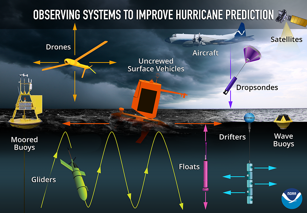
AOML Observational Instruments
Overview of NOAA AOML observing instruments
-
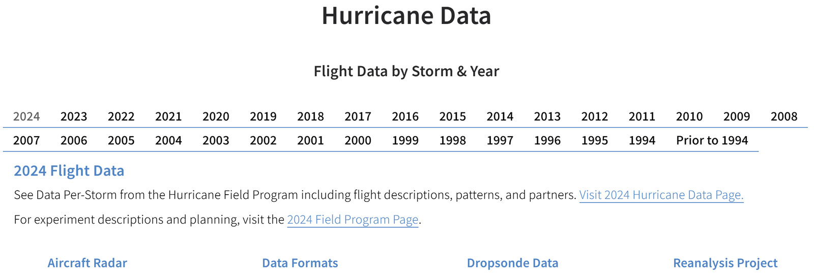
AOML Hurricane Field Observation
Hurricane field observations, including aircraft data
-
AOML Hurricane Radar Data
Hurricane radar data
-
NOAA Saildrone Hurricane Observations
Hurricane observations by uncrewed surface vehicles (Saildrone)
-
Local Observations and Impacts from Past Tropical Cyclones
NWS Key West summaries of past tropical cyclone observations and impacts