KOREA Oceanographic Database [2026.03.28]
Observational, satellite, and reanalysis datasets for the seas around the Korean Peninsula, organized by institution.
Ministry of Oceans and Fisheries (MOF)
MOF · VADAHUB
Data-sharing platform of the Ministry of Oceans and Fisheries, with downloads
Ministry of Oceans and Fisheries
VADAHUB observation platform
Data download (VADAHUB)
NIFS (National Institute of Fisheries Science)
KODC: Serial Oceanographic Observation
NIFS Serial Oceanographic Observation along fixed lines
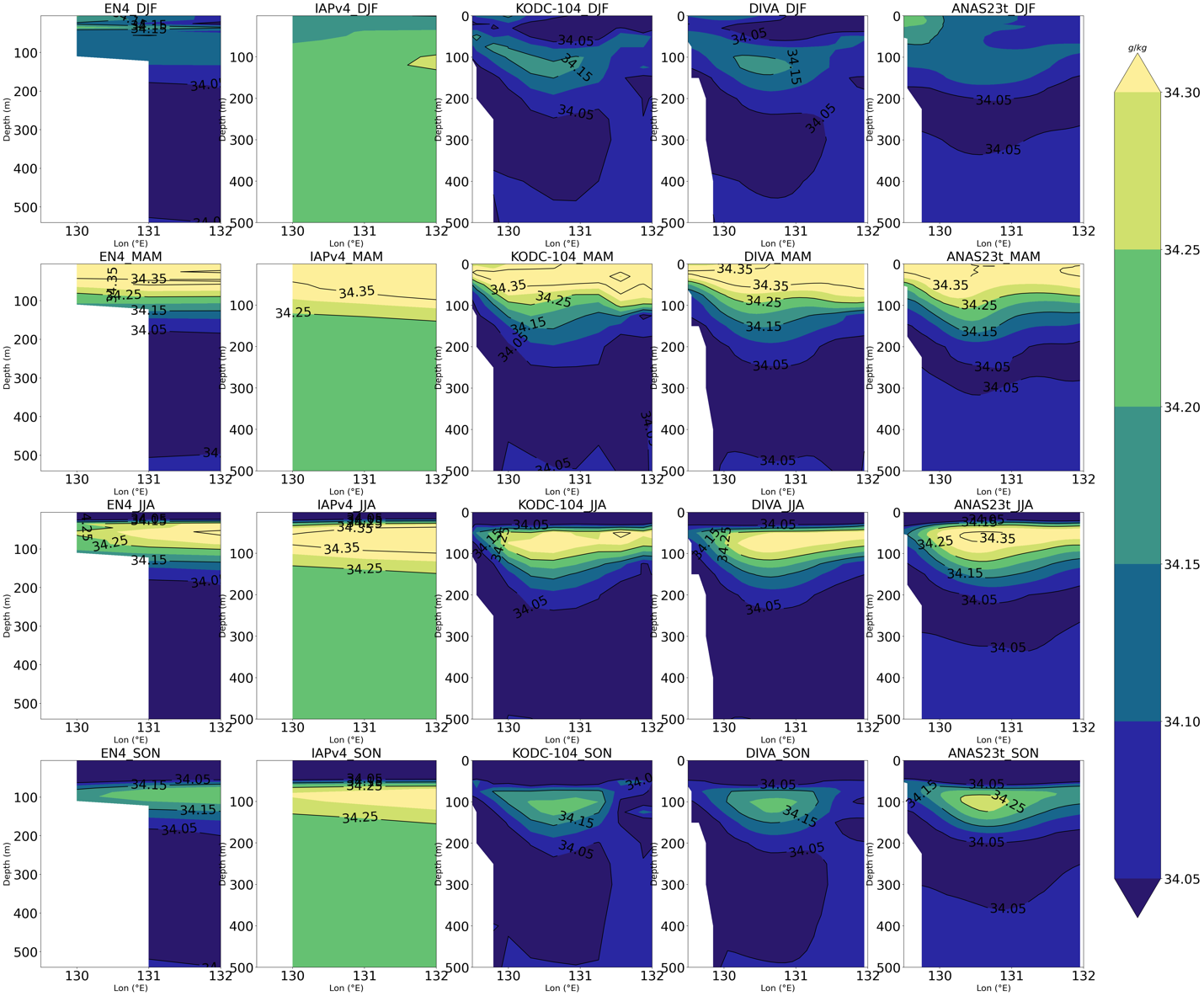
KODC: T/S climatology around the Korean Peninsula
1966–2023
Temperature and salinity climatology, and a DIVA-based gridded time series
KODC Atlas overview
Continuous Gridded Time Series of T/S around the Korean Peninsula using DIVA (v1, SEANOE)
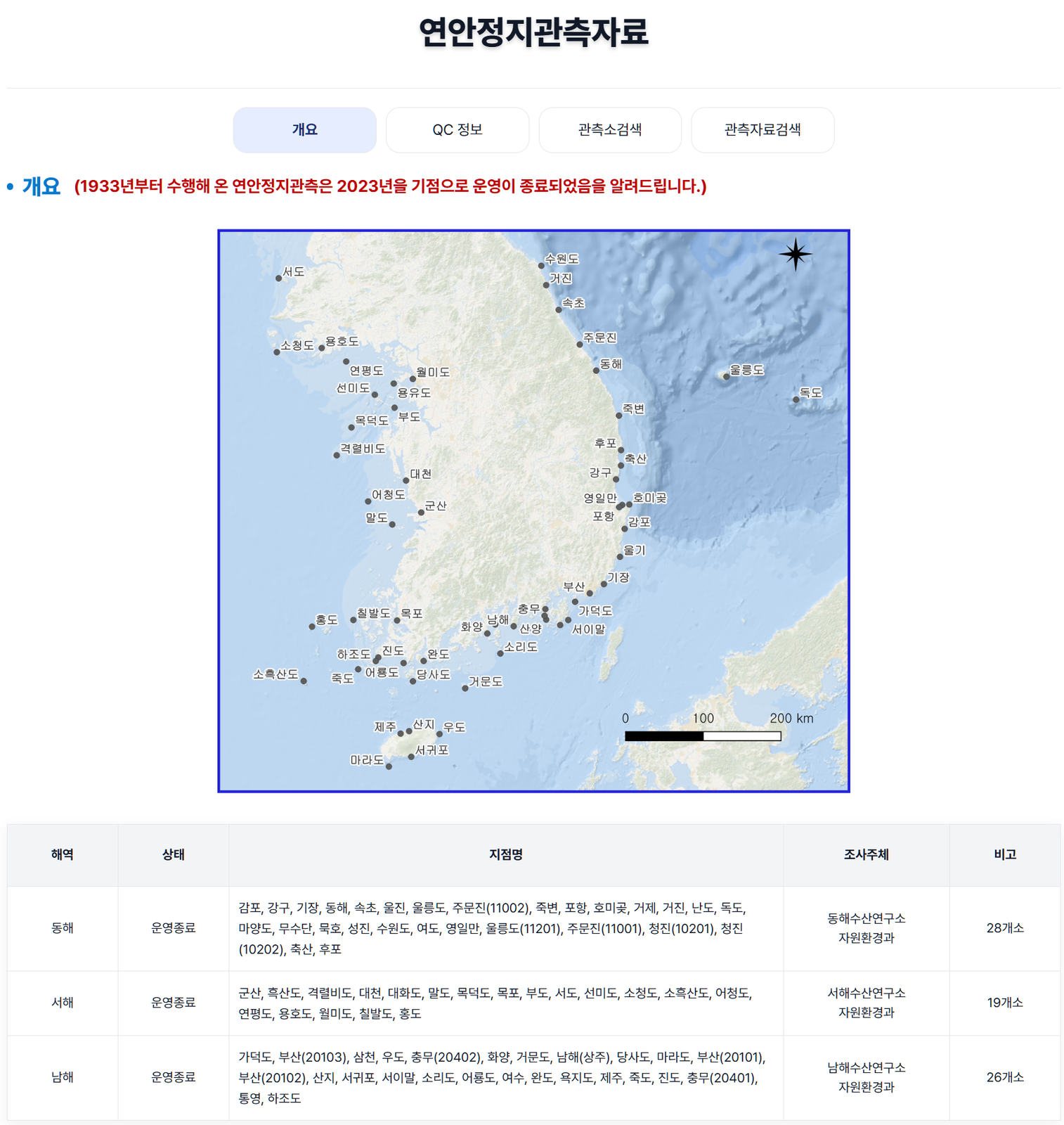
KODC: Coastal station observations
1933–2023
Long-term observations at fixed coastal stations
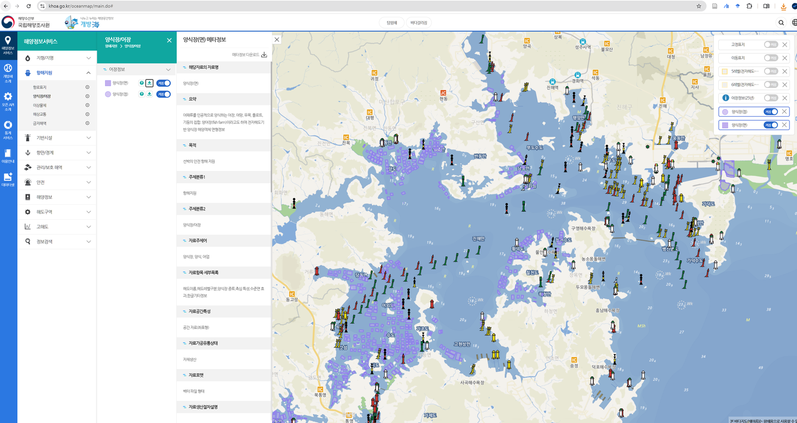
KHOA (Korea Hydrographic and Oceanographic Agency)
KHOA
Agency homepage and the KHOA ocean map. Aquaculture farm locations can be downloaded from the ocean map.
Badanuri · Real-time Ocean Observation Information System
Ocean Data in Grid Framework: buoys, surface drifters, and more
Badanuri ocean information map
Notes on Badanuri data (from a phone inquiry)
- Buoy, surface drifter, and other data served by Badanuri are given in KST (Korea Standard Time).
- The SVP drifters downloadable from Badanuri are not part of the GDP program.
- Surface drifter data can only be downloaded one at a time; there is no bulk download at present. [as of 2025.05.01]
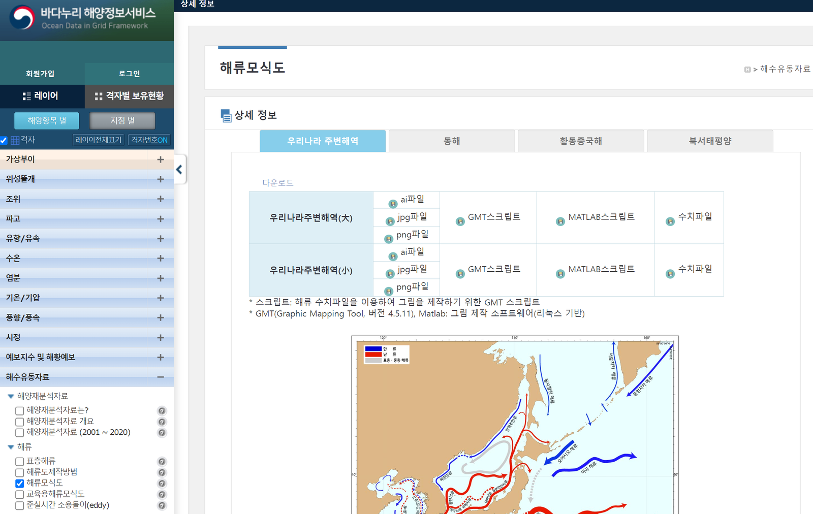
Current schematic around Korea
Schematic ocean current data for the seas around the Korean Peninsula, downloadable from Badanuri
Badanuri ocean information map
NOSC (National Ocean Satellite Center)
GOCI-II
GOCI-II data download, with OPeNDAP access
Python and OPeNDAP: GOCI-II data download
Open the OPeNDAP link above, find the nc file you need, and click the "html" option.
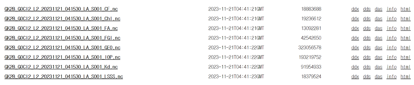
Put that "html" address into the variable url in the code below.
MEIS (Marine Environment Information System)
MEIS marine environment monitoring network
Regular marine environment monitoring. The map view is useful for checking which observations exist where.
Sea turtle tracks
Published tracking data and how to request the MBRIS open-data API
KIOST (Korea Institute of Ocean Science and Technology)
KIOST
Institute homepage and the Ocean Science Library
KIOST
Ocean Science Library
KIOST Data Portal (site not reachable)
KORS (Korea Ocean Research Stations)
Ieodo, Sinan-Gageocho, and Ongjin-Socheongcho ocean research stations. In practice, downloading from Badanuri is easier than from the KORS site.
KORS data portal
Badanuri ocean information map
Data paper on the Ieodo station (Scientific Data, with data)
Location of KORS
| Location | Longitude (°) | Latitude (°) | Longitude (DMS) | Latitude (DMS) | Observation start |
|---|---|---|---|---|---|
| Ieodo Ocean Research Station | 125.1822 | 32.1228 | E 125° 10' 55.92" | N 32° 07' 22.08" | |
| Sinan-Gageocho Ocean Research Station | 124.5928 | 33.9419 | E 124° 35' 34.08" | N 33° 56' 30.84" | |
| Ongjin-Socheongcho Ocean Research Station | 124.7381 | 37.4231 | E 124° 44' 17.16" | N 37° 25' 23.16" | |
| Yellow Sea Buoy | E 123° 00' 12" | N 35° 15' 30" | 2018/10/21 |
% OSD location
osdll = dms2degrees([37, 25, 23.16; 124, 44, 17.16; 35, 15, 30; 123, 00, 12; ...
    32, 07, 22.08; 125, 10, 55.92; 33, 56, 30.84 ; 124, 35, 34.08]);
m_scatter(osdll(2), osdll(1), 200, 'magenta', 'filled', 'marker', 'square', 'MarkerEdgeColor', 'k', 'LineWidth', 1.5)
m_text(osdll(2) - 0.27, osdll(1)+0.02, 'Ongjin-Socheongcho Ocean Research Station', ...
    'Color', 'magenta', 'HorizontalAlignment', 'right', 'FontWeight', 'Bold', 'FontSize', 15,'Fontname','Consolas');
m_scatter(osdll(4), osdll(3), 200, 'cyan', 'filled', 'marker', 'square', 'MarkerEdgeColor', 'k', 'LineWidth', 1.5)
m_text(osdll(4) - 0.27, osdll(3)+0.02, 'Yellow Sea Buoy', ...
    'Color', 'cyan', 'HorizontalAlignment', 'right', 'FontWeight', 'Bold', 'FontSize', 15,'Fontname','Consolas');
m_scatter(osdll(6), osdll(5), 200, 'magenta', 'filled', 'marker', 'square', 'MarkerEdgeColor', 'k', 'LineWidth', 1.5)
m_text(osdll(6) - 0.27, osdll(5)+0.02, 'Ieodo Ocean Research Station', ...
    'Color', 'magenta', 'HorizontalAlignment', 'right', 'FontWeight', 'Bold', 'FontSize', 15,'Fontname','Consolas');
m_scatter(osdll(8), osdll(7), 200, 'magenta', 'filled', 'marker', 'square', 'MarkerEdgeColor', 'k', 'LineWidth', 1.5)
m_text(osdll(8) - 0.27, osdll(7)+0.02, 'Sinan-Gageocho Ocean Research Station', ...
    'Color', 'magenta', 'HorizontalAlignment', 'right', 'FontWeight', 'Bold', 'FontSize', 15,'Fontname','Consolas');
OCPC (Ocean Climate Prediction Center)
SST, sea level, marine precipitation, sea level pressure, marine air temperature, wind speed, significant wave height, mean wave period, sea ice extent and thickness, El Niño and La Niña, Indian Ocean Dipole, and Changjiang (Yangtze) freshwater discharge
Observation datasets (East Sea and Korean marginal seas)
CREAMS / EAST-I hydrographic CTD
1993–2016
922 CTD temperature and salinity profiles from 19 international joint surveys in the East Sea (Japan Sea), under the CREAMS program and the EAST-I project
KIOST_CTD
1983–1991
CTD temperature and salinity at 916 stations around the Korean Peninsula (Year, Month, Day, Lon, Lat, depth, T, S)
(SNU) EC1 mooring
1996.11–2023.04
Deep mooring in the Ulleung Interplain Gap (UIG) between Ulleungdo and Dokdo (37.33°N, 131.45°E, about 2,300 m depth)
SNU OOL: EC1 mooring data
SEANOE (1996-11 to 2020-11)
SEANOE (2020-11-12 to 2023-04-25)
About EC1
The EC1 mooring, at 37.33°N, 131.45°E between Ulleungdo and Dokdo in about 2,300 m of water, has been operated since November 1996 to quantify the temporal variability of the deep flow through the Ulleung Interplain Gap (UIG). It is a subsurface mooring, recovered and redeployed about once a year according to the sampling intervals and battery capacity of the attached instruments. As of 2020-09-22 the 23rd deployment was in progress. RCM and Aquadopp current meters are mounted at three standard depths (400, 1400, and 2200 m), with ADCP, SBE 39, and SBE 37 instruments during some periods. Sampling intervals are 15, 30, or 60 minutes, mostly within 60 minutes. Dissolved oxygen sensors were added at 1400 m and 2250 m in 2017.
(SNU) ESROB
1999.04–2020.10
East Sea Real-time Ocean Buoy, about 8 km east of Mukho Harbor (37° 34.38'N, 129° 12.918'E, 130 m depth)
SNU OOL: ESROB data
SEANOE (1999-04-25 to 2016-08-01)
SEANOE (2016-08-05 to 2020-10-27)
About ESROB
The East Sea Real-time Ocean Buoy (ESROB) is moored about 8 km off Mukho Harbor (37° 34.38'N, 129° 12.918'E) in 130 m of water and has operated since 25 April 1999. Data from its atmospheric and oceanic sensors are transmitted to a server in real time for ocean monitoring. Physical variables (wind, waves, temperature, salinity, currents) have been measured from the start; biological and chemical sensors were added in April 2011 and short- and long-wave radiation sensors in October 2011, making it a multidisciplinary coastal buoy. Maintenance is carried out by Otronix Co., with monthly inspections from the vessel Tamsa 2, additional visits when problems arise, and full recovery for onshore servicing about once a year.
(SNU) SAVEX15
Moored and ship-based data from the Shallow-water Acoustic Variability EXperiment
(SNU) Deep moored currents, southwestern East Sea
Deep moored current and hydrographic measurements in the southwestern East Sea (Japan Sea)
KOPRI (Korea Polar Research Institute)
KPDC (Korea Polar Data Center)
Collects and manages all research data from Korean polar research since the King Sejong Station began in 1988. Raw data are provided on request for scientific, non-commercial use.
KAOS (Korea Arctic Ocean Observing System)
Physical, chemical, and biological observations from the western Arctic Ocean, with a web GIS that visualizes past and present sea ice, ocean, and ecosystem change together with future projections
Other institutions
APCC (APEC Climate Center)
Climate prediction information and the CLIK toolkit
JOISS (Jurisdictional Ocean Information Sharing System)
Jeju coastal environment information
Extra sources
Korea shapefile
National Atlas of Korea (National Geographic Information Institute)
Territorial sea limits and baselines of Korea
Rivers of Korea
Korea Strait transport
Time-series figures at NIFS; raw data at Badanuri (Download → Shared data → Korea Strait transport)
Time series (NIFS, figures only)
Badanuri ocean information service
How the Korea Strait transport is derived
- Time series: the NIFS link shows figures only; raw data are not provided there.
-
Download: Badanuri ocean information service → Download → Shared data → Korea Strait transport. A service providing the raw data opened recently.
-
Jeju Strait (inflow): from the Wando and Jeju tide gauges
- Jeju to Kyushu (inflow): Korea Strait (outflow) minus Jeju Strait (inflow)
- Korea Strait (outflow): from the Busan and Hakata tide gauges
- Western channel of the Korea Strait (outflow): from the Busan and Izuhara tide gauges
- Eastern channel of the Korea Strait (outflow): from the Izuhara and Hakata tide gauges