Pacific Ocean [2026.05.12]
Long-term moorings, the Kuroshio Extension, and national observation programs (Korea, Japan, China, Taiwan) in the Pacific.
Blocks with a .model-card layout list one dataset each, so every dataset appears in the table of contents on the right.
Long-term moorings
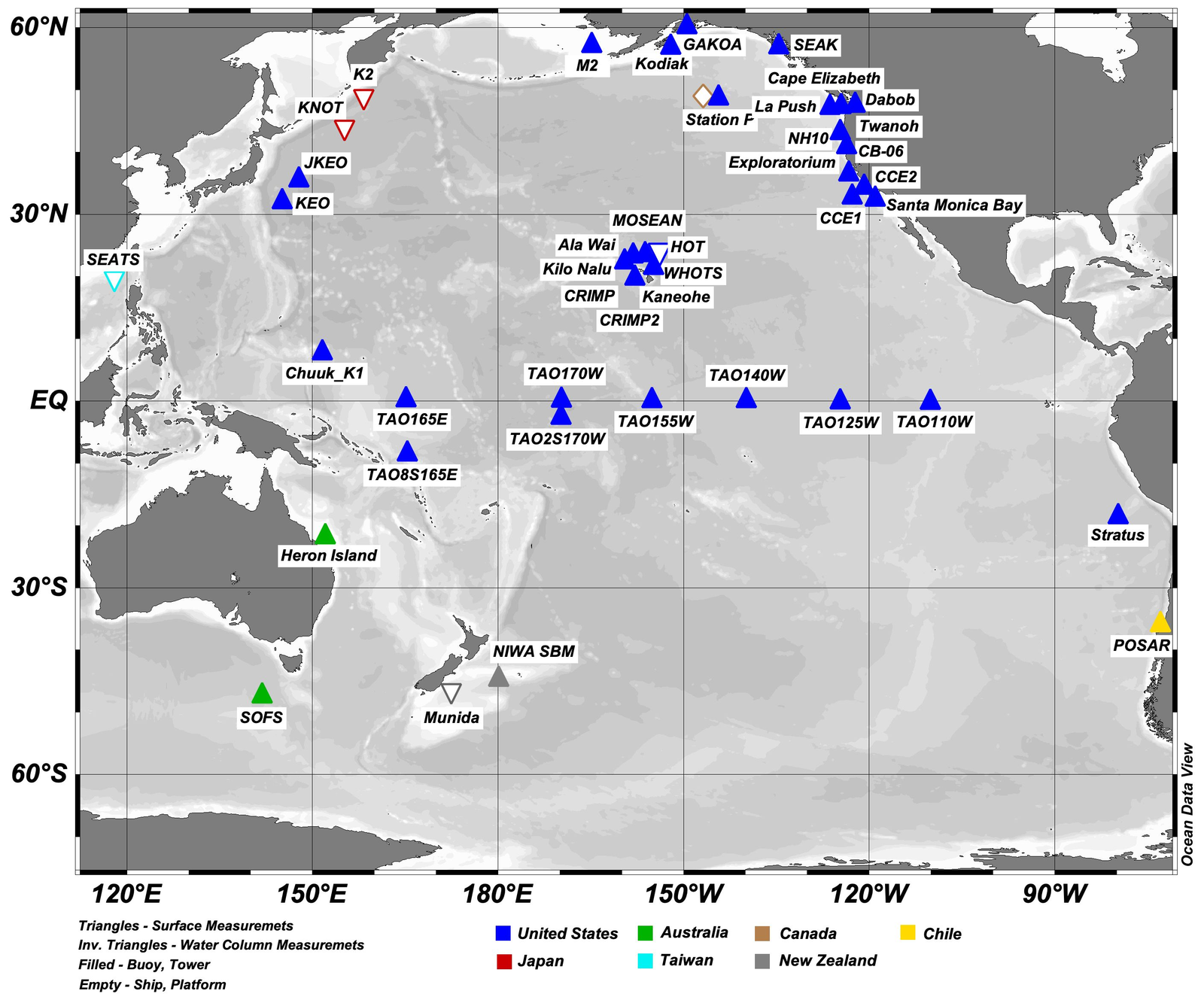
OceanSITES (TAO, TRITON etc.)
Global network of long-term reference moorings, including the tropical Pacific TAO/TRITON arrays.
Pacific Ocean CO2 Time-series and Moorings (OCADS)
NOAA NCEI Ocean Carbon and Acidification Data System: CO2 time-series and mooring project, Pacific Ocean.
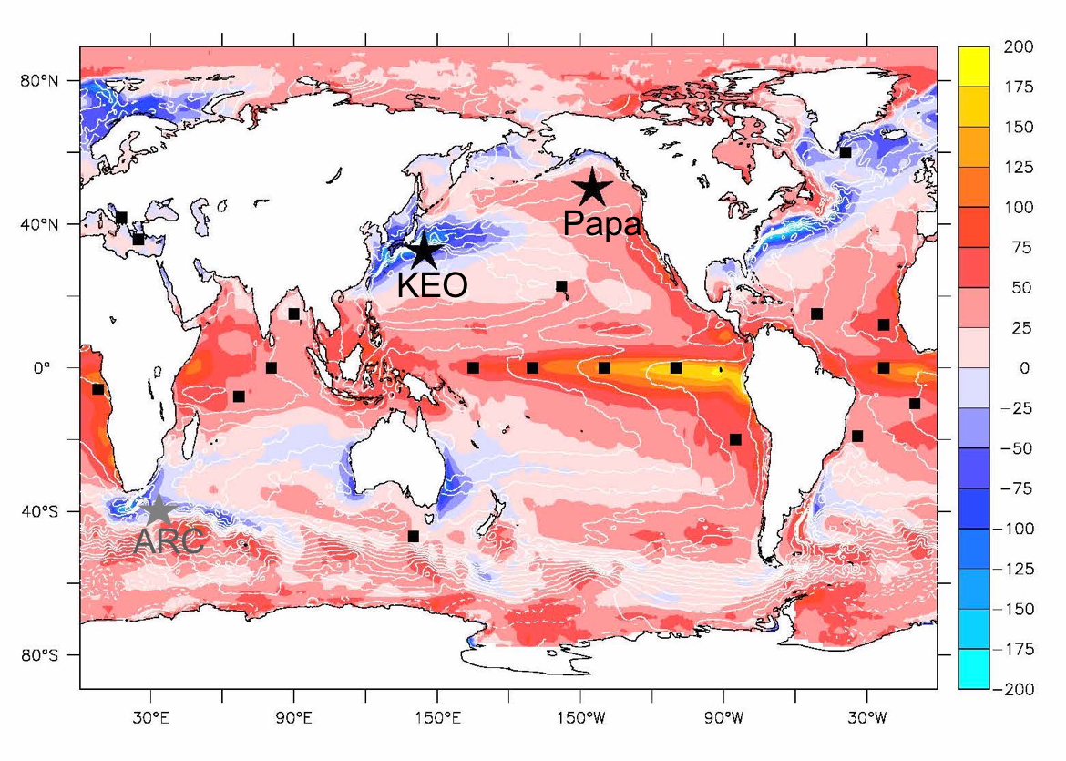
Ocean Climate Stations (KEO, Papa, ARC)
PMEL Ocean Climate Stations: reference time-series moorings. The Kuroshio Extension Observatory (KEO) is part of this network.
OCS Mooring Data
Kuroshio Extension Observatory (KEO)
PMEL Ocean Climate Stations as Reference Time Series and Research Aggregate Devices (Oceanography)
In situ SST for validation (iQuam)
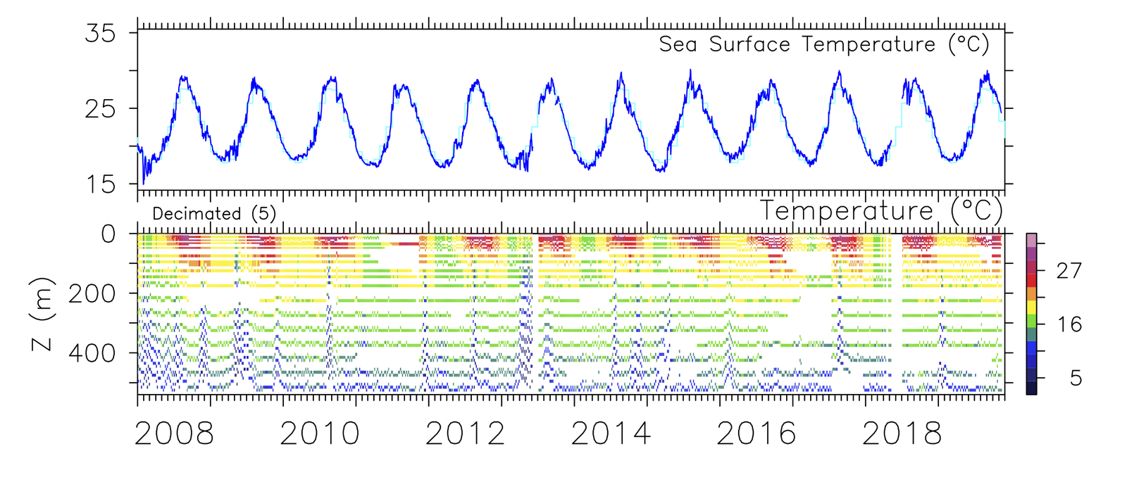
Kuroshio Extension
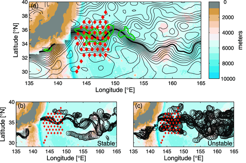
KESS CPIES/PIES array (+ KEO)
Kuroshio Extension System Study inverted echo sounder array; the CAS data center also distributes a combined KESS + KEO set.
KESS Data (URI)
KESS (CAS Oceanographic Data Center)
KESS + KEO (CAS Oceanographic Data Center)
CKEO
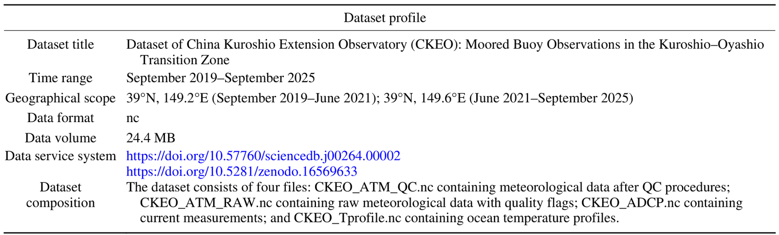
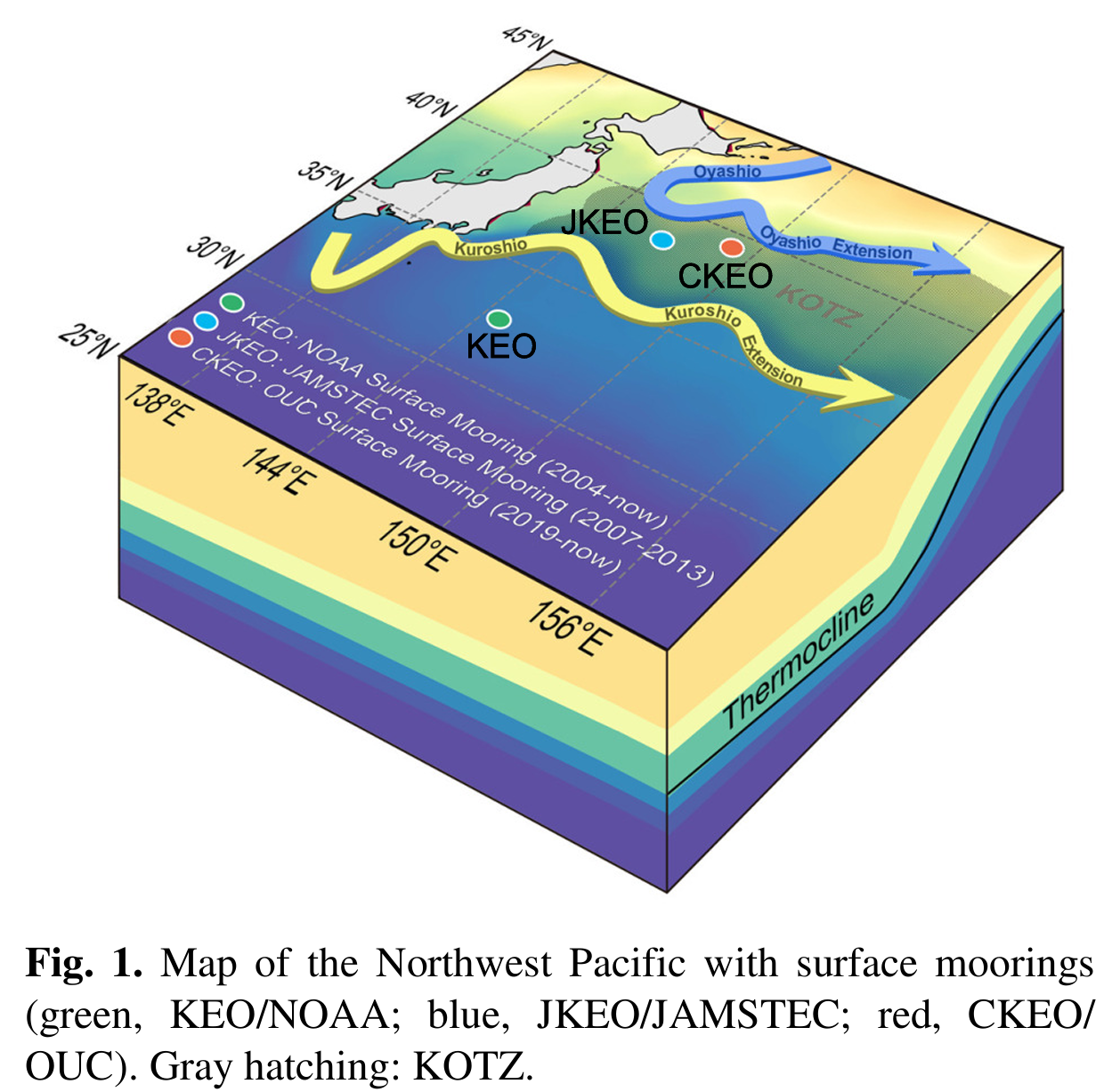
China Kuroshio Extension Observatory: moored buoy observations in the Kuroshio–Oyashio transition zone.
Dataset paper (Adv. Atmos. Sci.)
CKEO dataset (ScienceDB)
CKEO dataset (Zenodo)
KEMS
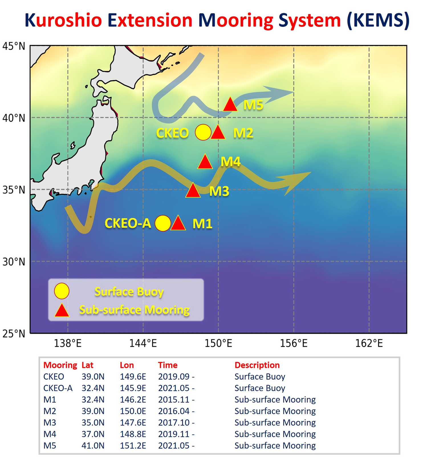
Kuroshio Extension Mooring System. The mooring data are distributed from the KEMS website as a split archive.
KEMS
data.zip.001 · data.zip.002
Estimating the Volume Transport of Kuroshio Extension Based on Satellite Altimetry and Hydrographic Data (JTECH)
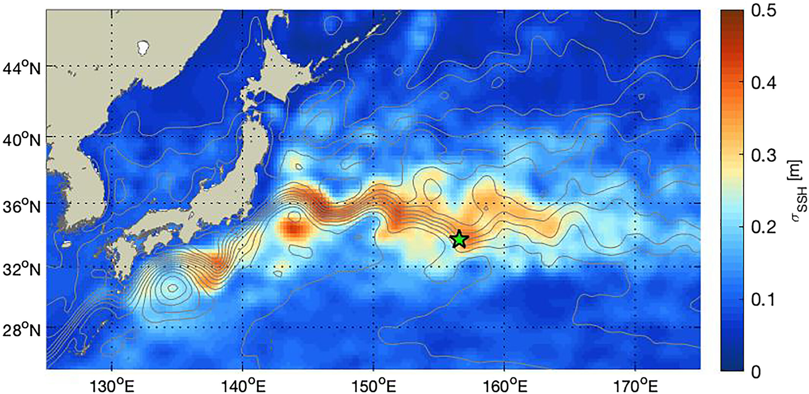
Near-inertial velocity mooring
33°43'N, 156°34'E · 2017.11 to 2019.10
A subsurface mooring in the Kuroshio Extension with a 75 kHz ADCP (about 600 m range, 16 m bins), used to study near-inertial wave energy flux.
Mesoscale Flow Impacts on Downward Energy Flux of Near-Inertial Waves in the Kuroshio Extension (JGR Oceans)
Zenodo dataset
Korea
-
KOREA Oceanographic Database
Korean national observation networks, gridded products and download guides.
-
Regional gridded datasets around the Korean Peninsula
Listed in Notion by title only: 한반도 주변해 해양 기후 평년 자료 (ocean climate normals around Korea) and Data-Driven Multidecadal Reconstruction and Nowcasting of Coastal and Offshore 3-D Sea Temperature Fields from Satellite Observations: A Case Study in the East/Japan Sea. See Atlas & Climatology.
-
NWP Ocean Climate Data Service
Northwest Pacific ocean climate data service.
Japan
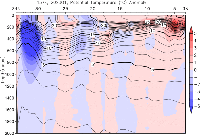
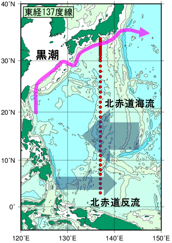
137°E meridian section time-series (JMA)
Oceanographic section time-series dataset for the 137°E meridian, maintained by JMA since 1967.
JMA 137°E dataset
Related dataset (CAS Oceanographic Data Center)
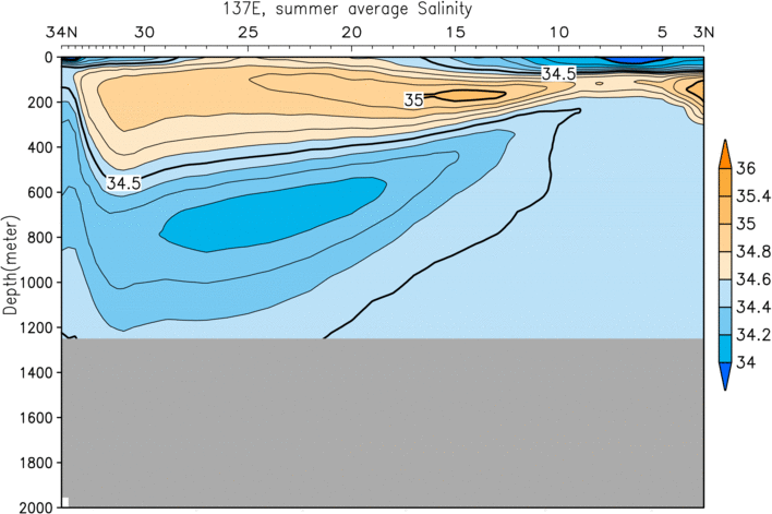
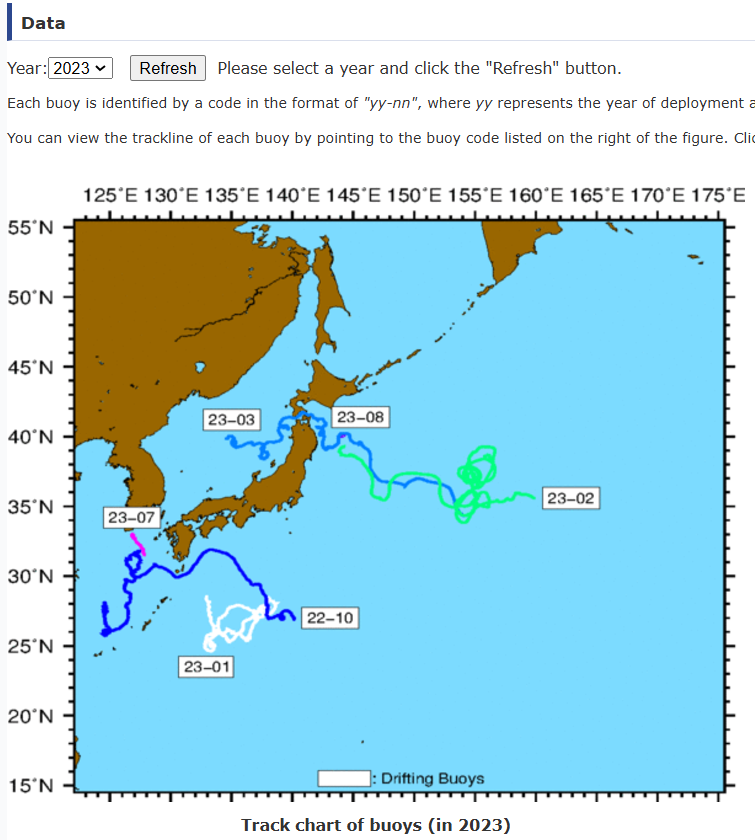
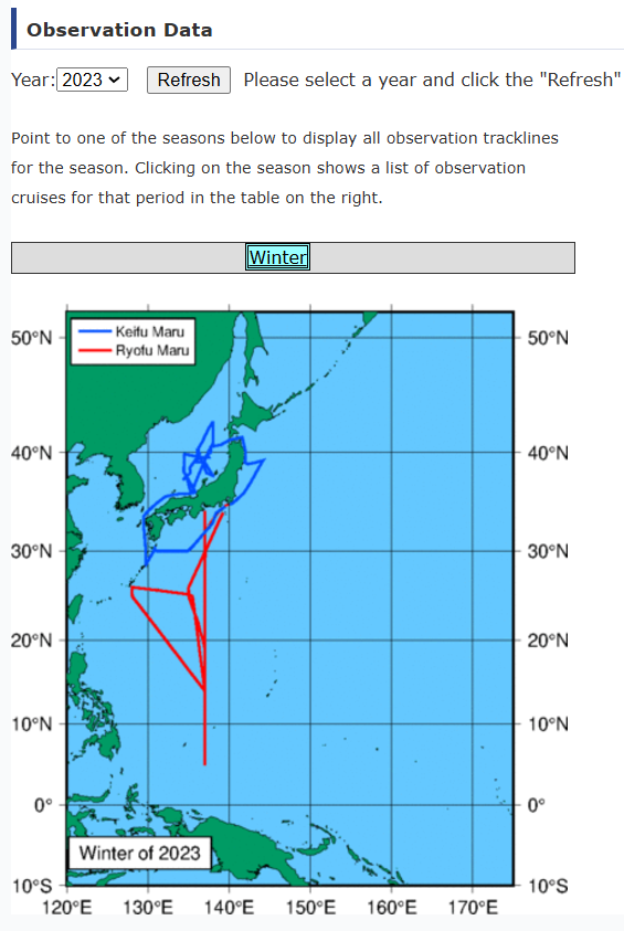
JMA research vessel observations
1997 to 2023
Oceanographic and marine meteorological observations by JMA research vessels. Files are provided as text; each data type has its own fixed format, which also differs by observation method, so check the format document for the variable you need on the JMA page.
JMA Research Vessel data
JMA subsurface current data format (PDF)
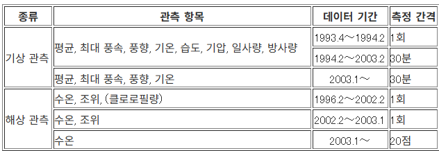
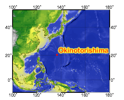
Okinotorishima Island observations
1993 to present
Meteorological and oceanographic observations collected at Okinotorishima Island since 1993. The latest data are added around April each year.
JAMSTEC Okinotorishima
GODAC metadata
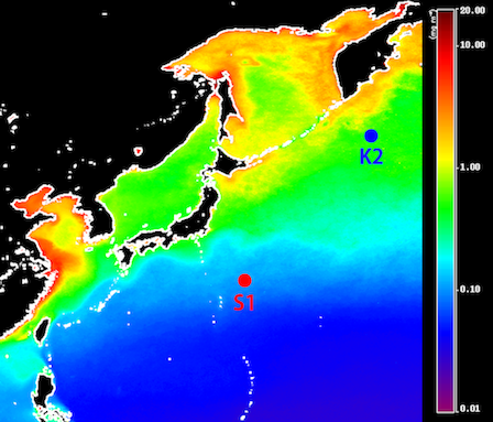
Time-series stations K2 and S1 (JAMSTEC)
K2: 47°N, 160°E (western subarctic gyre) · S1: 30°N, 145°E (subtropical gyre)
Biogeochemical time-series stations of the Marine Biogeochemical Cycle Research Team. Since 2010 the R/V Mirai has conducted comparative time-series observations at the two stations.
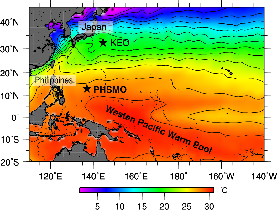
PHSMO: Philippine Sea Mooring
13°N, 137°E · 2016.12 to present
JAMSTEC moored buoy east of the Philippines, at the northern edge of the western Pacific warm pool.
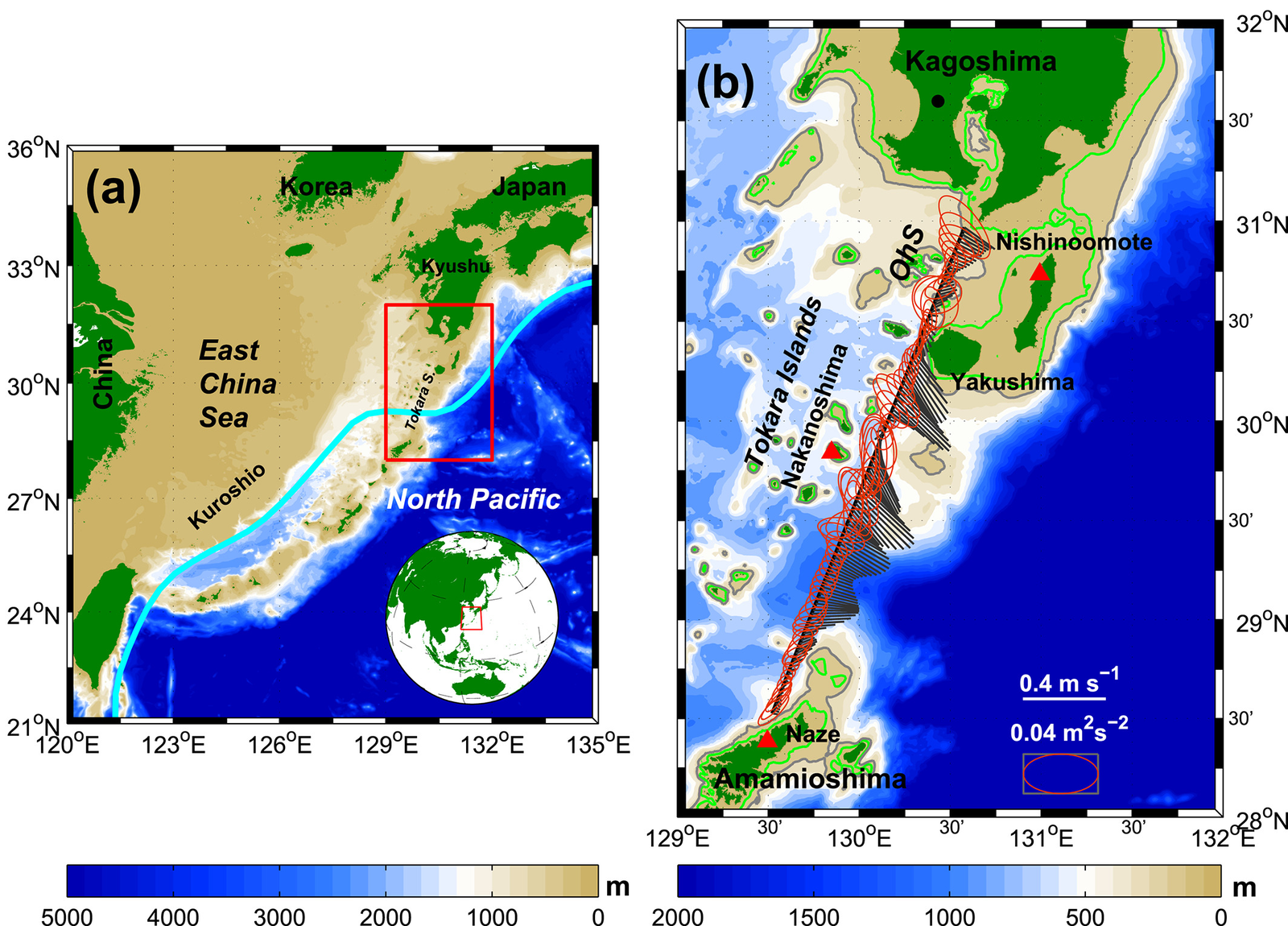
Tokara Strait ferryboat ADCP
Long-term ferryboat ADCP observations of the Kuroshio in the Tokara Strait.
Tempo-Spatial Variations of the Kuroshio Current in the Tokara Strait Based on Long-Term Ferryboat ADCP Data (JGR Oceans)
data_tokara (Baidu Netdisk)
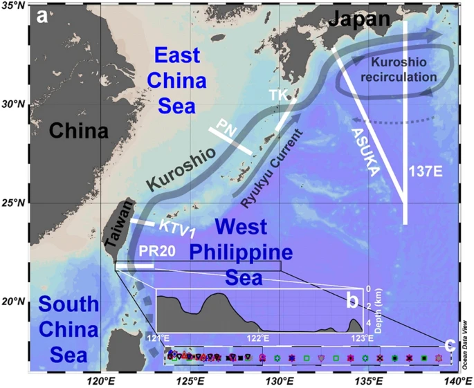
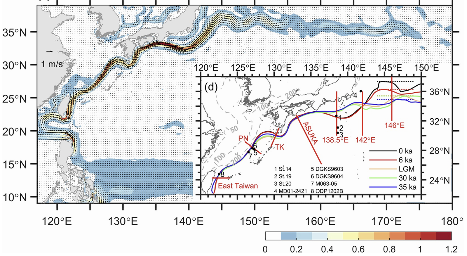
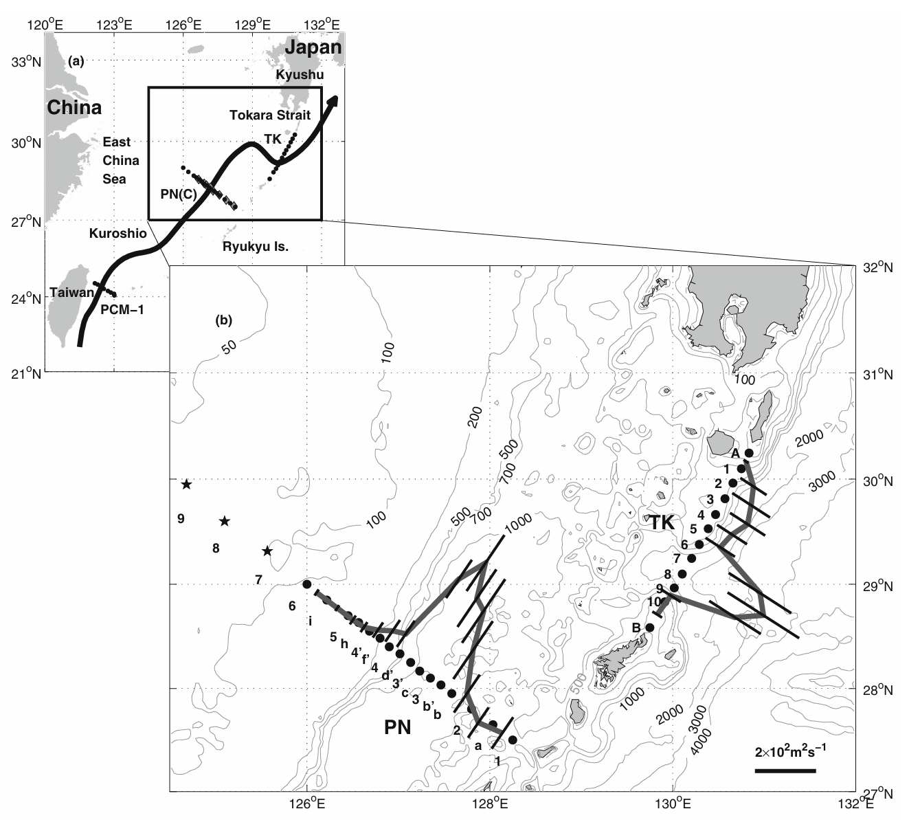
PN line
JMA Okinawa repeat section across the Kuroshio in the East China Sea.
沖縄気象台 PN線 (JMA Okinawa)
PN line (CAS Oceanographic Data Center)
Reference (J. Oceanogr.)
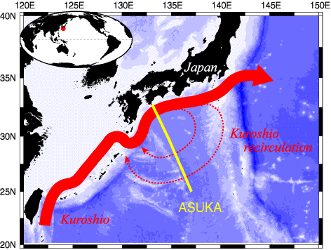
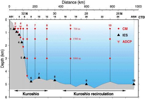
ASUKA line
Project on the structure and dynamics of the Kuroshio off southwest Japan.
ASUKA project (URI)
Uchida et al.
Satellite altimeter monitoring the Kuroshio transport south of Japan (GRL)
ASUKA hydrographic data (RIAM, PDF)
Data (RIAM)
FRA real-time buoy
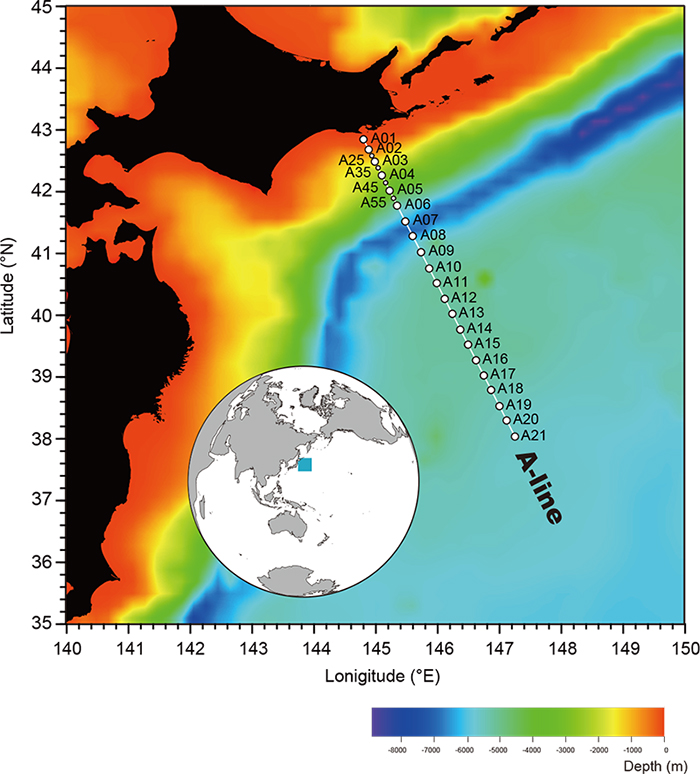
FRA A-line and N-line
Repeat sections of the Fisheries Research Agency (FRA). N-line data are archived at NOAA OCADS.
A-line Monitoring
OCADS: FRA Near Japan Sections (N-line)
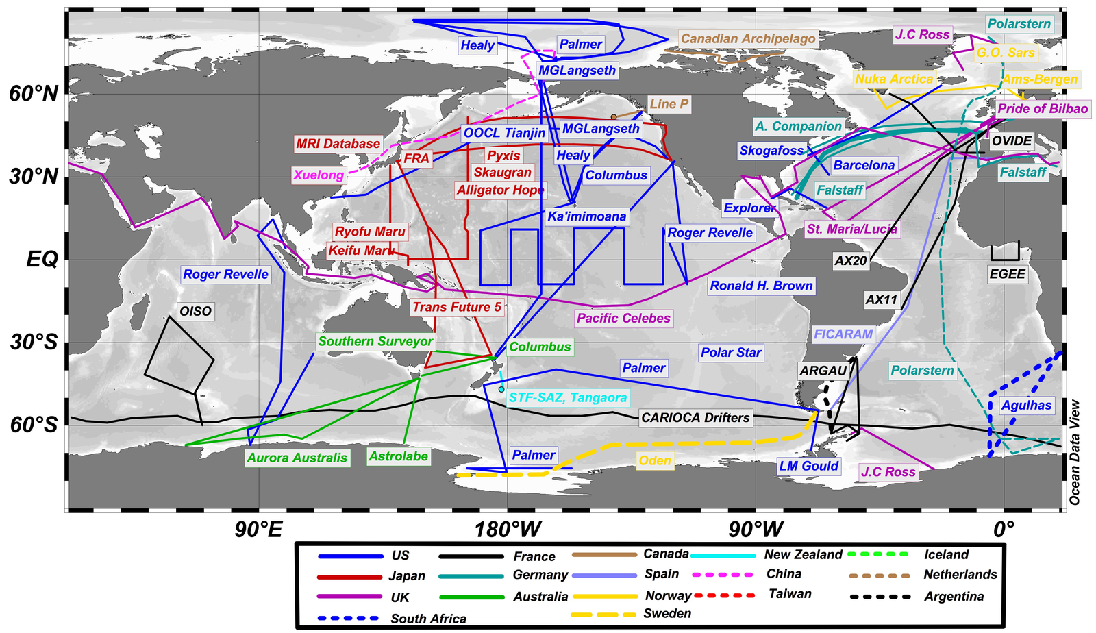
China
Data portals
-
NPOCE
Northwestern Pacific Ocean Circulation and Climate Experiment
-
CAS Oceanographic Data Center (海洋科学大数据中心)
-
National Marine Science Data Center (国家海洋科学数据中心)
Datasets
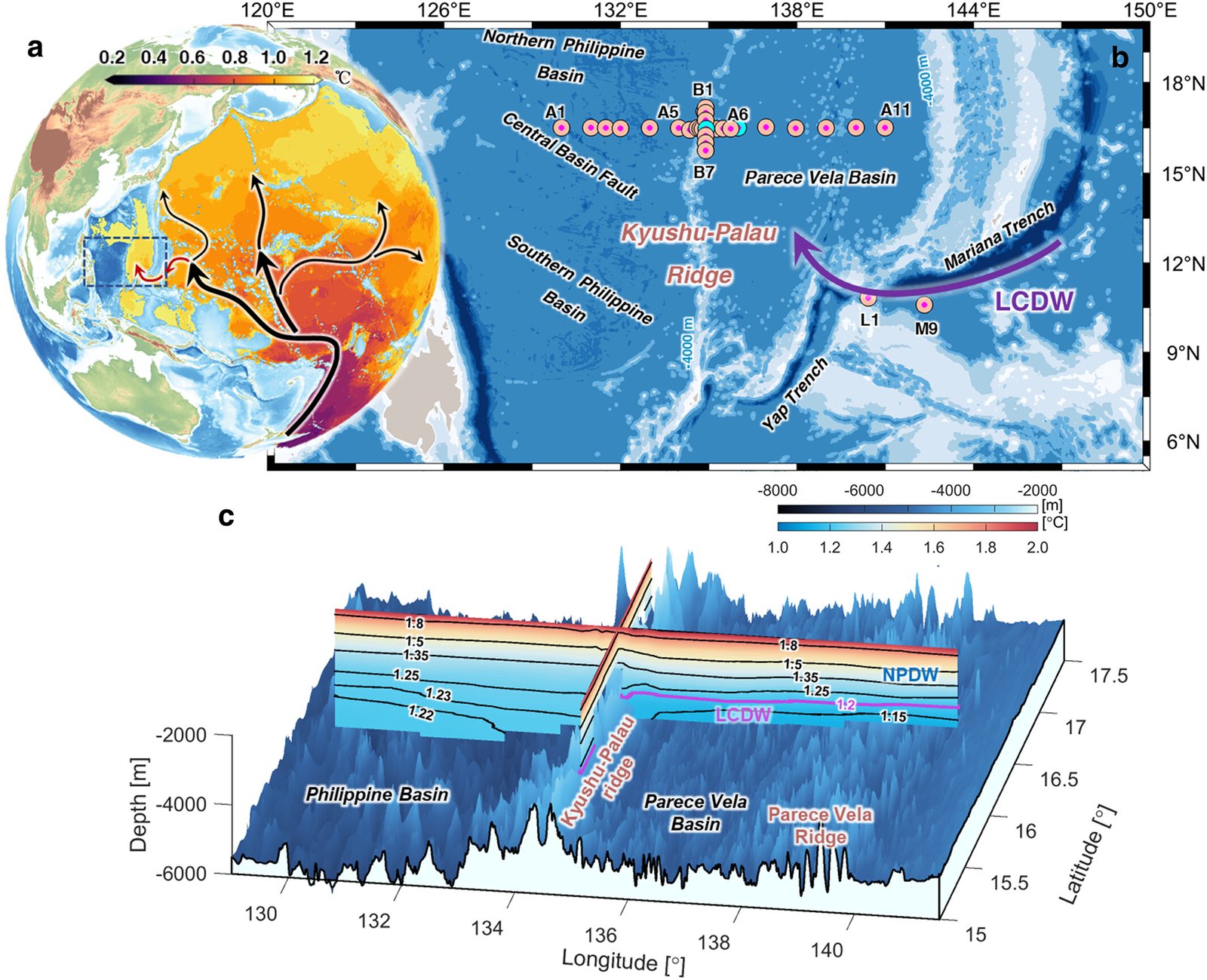
Diapycnal upwelling over the Kyushu-Palau Ridge
2021.09.23 to 2021.10.22
Hydrographic observations at 31 stations (Seabird 911 Plus CTD).
Diapycnal Upwelling Over the Kyushu-Palau Ridge in the North Pacific Ocean (GRL)
Zenodo dataset
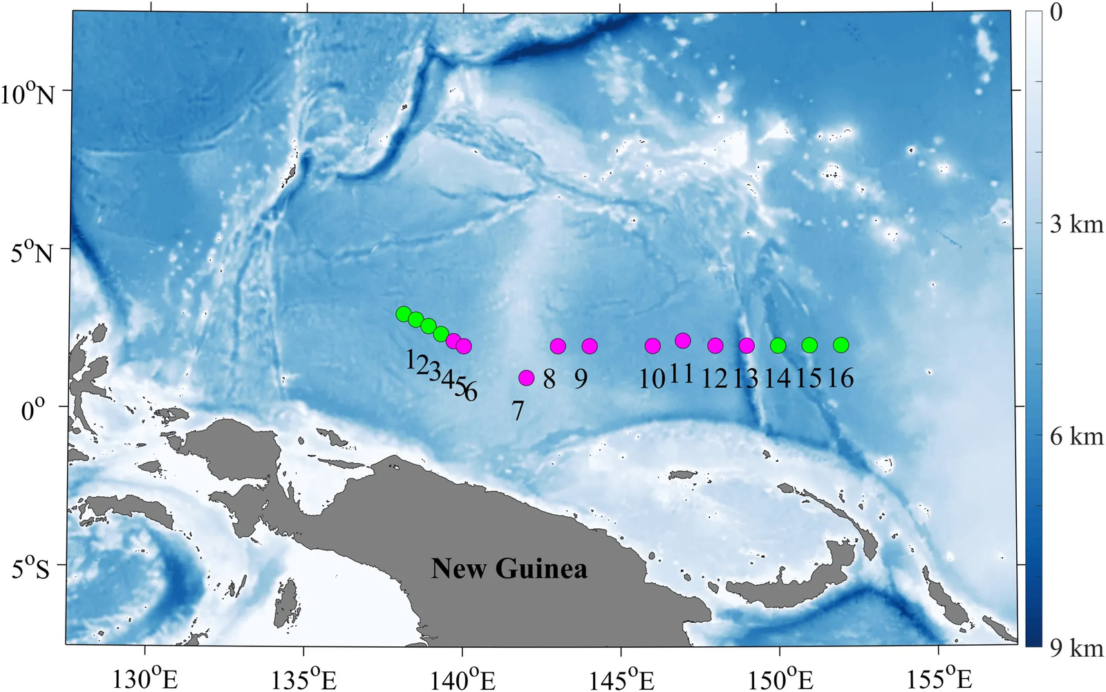
Mixing in the upper western equatorial Pacific driven by a westerly wind event
2018.12.17 to 2018.12.28
16 stations along 1 to 3°N, 138 to 152°E. Microstructure (VMP500), CTD, LADCP and automatic weather station data.
Mixing in the upper western equatorial Pacific driven by westerly wind event (Frontiers)
Zenodo dataset
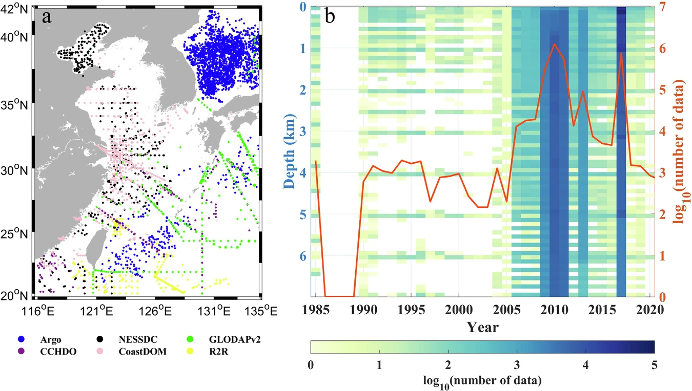
Regional ocean database for the Coastal China Sea
A regional ocean database for the Coastal China Sea (Scientific Data)
CODC-v1
1940 to 2023
Quality-controlled and bias-corrected ocean temperature profile database.
Scientific Data paper
CAS Oceanographic Data Center
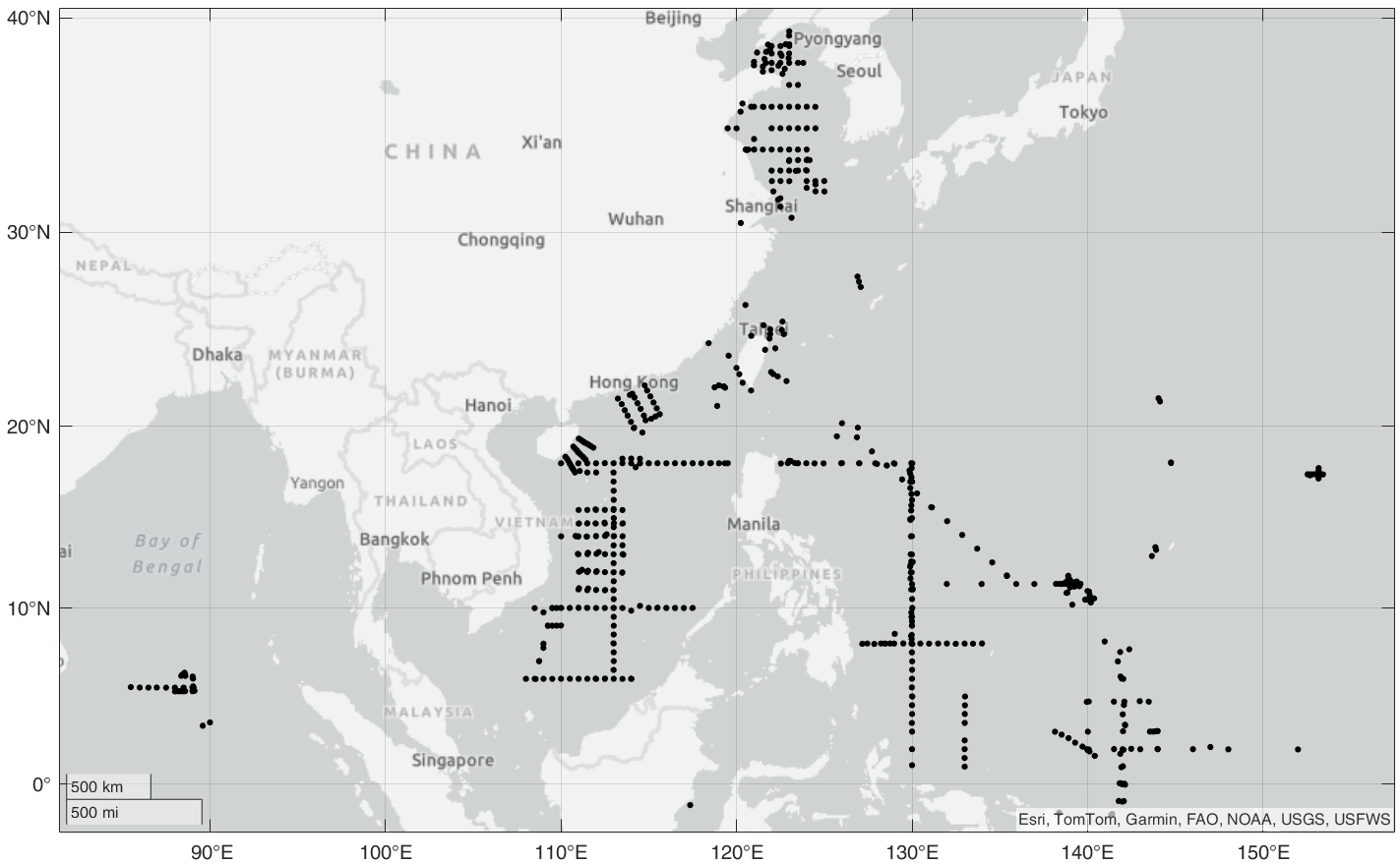
IAPv4
Gridded ocean temperature and ocean heat content dataset (IAP/CAS).
ESSD paper
Temperature (doi:10.12157/IOCAS.20240117.002)
OHC (doi:10.12157/IOCAS.20240117.001)
IAP ocean
Western Pacific subsurface moorings (CAS / NPOCE)
The numbering follows the original Notion page. Several datasets share stations or periods; see the "Overlap" column.
| # | Location | Period | Data | Overlap |
|---|---|---|---|---|
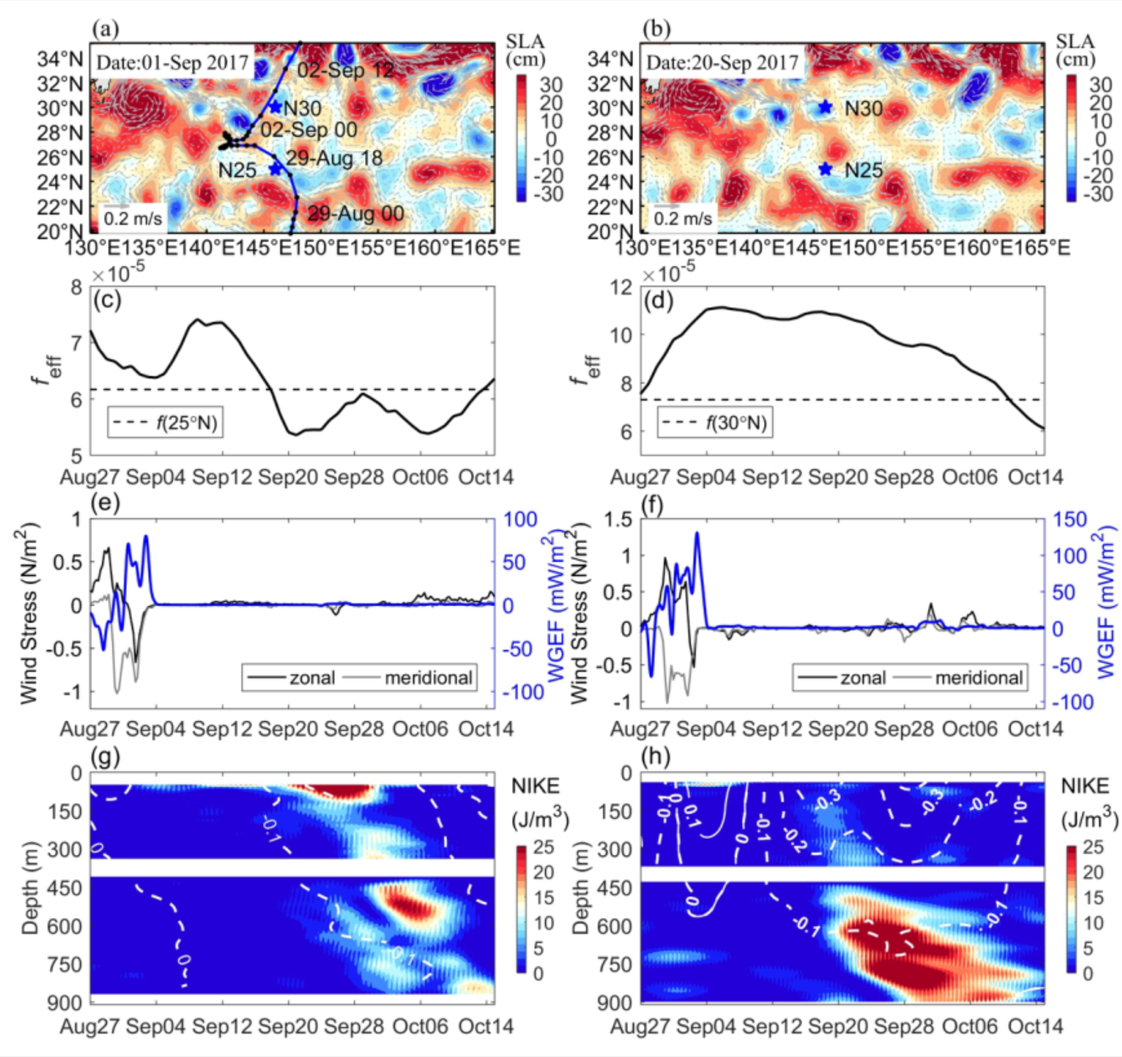
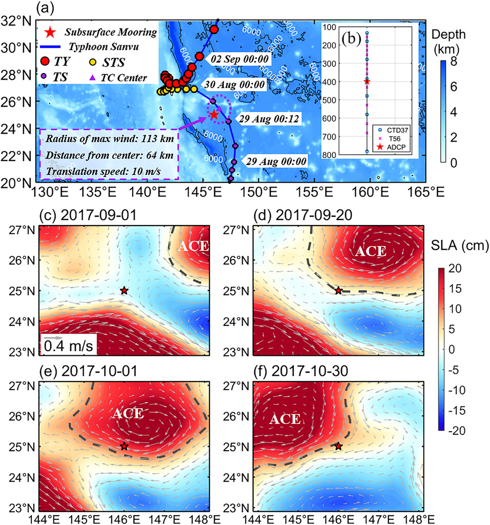
| 1 | 146°E, 25°N & 30°N | 2017.08 to 2017.12 | CAS ODC (Typhoon Sanvu) · Paper (JPO) | 8 |
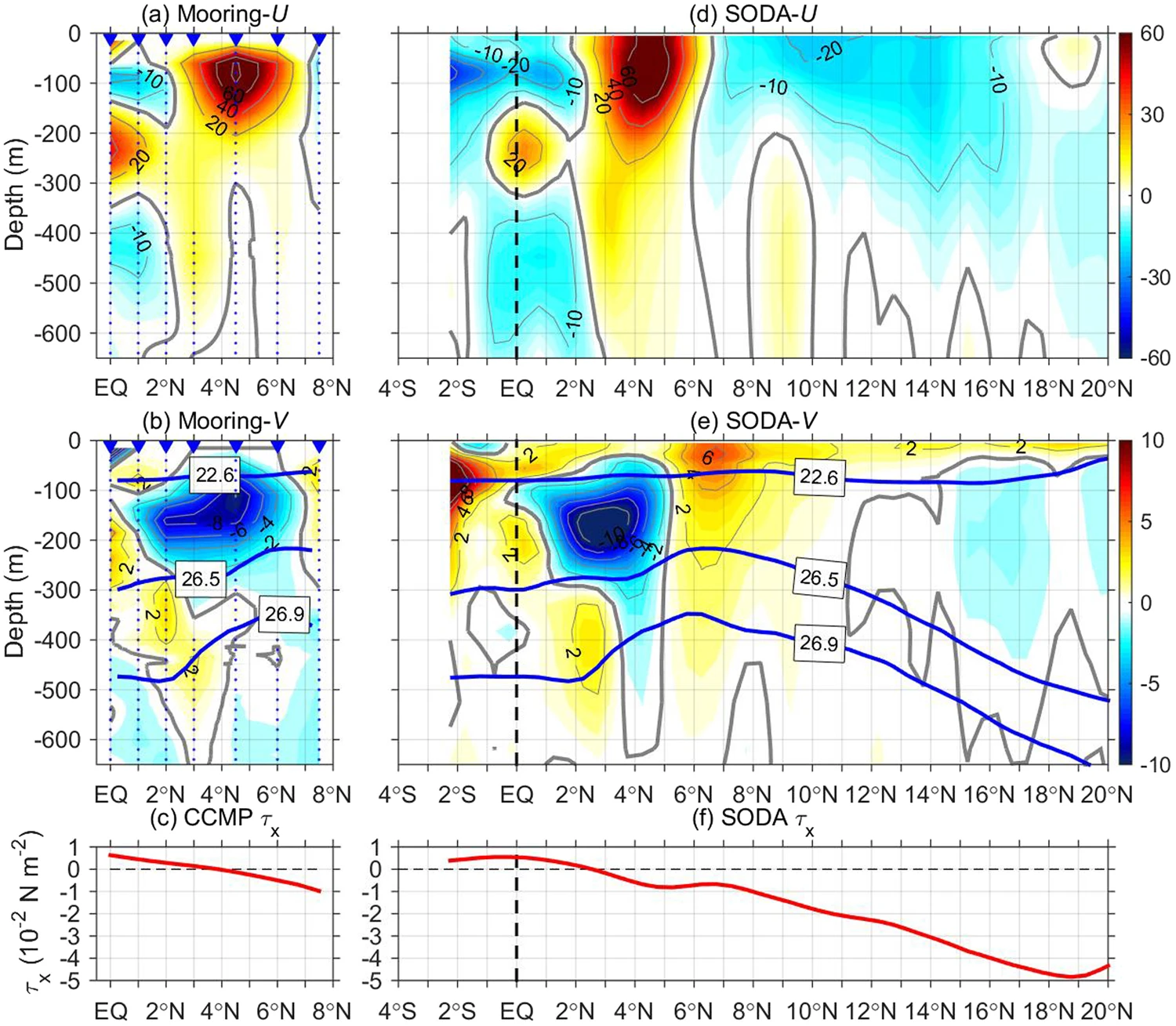
| 2 | 142°E, 0 to 7.5°N (7 moorings) | 2014.08 to 2015.10 | Paper + supplementary xlsx (Sci. Rep.) | 4 |
| 3 | 140°E, 4.7°N | 2014.01 to 2018.12 | Zenodo · Paper (JGR) | 4 |
| 4 | 130°E, 140°E, 142°E (15 moorings) | 2014.11 to 2015.06 | Zenodo · Paper (JGR) | 2, 3, 5 |
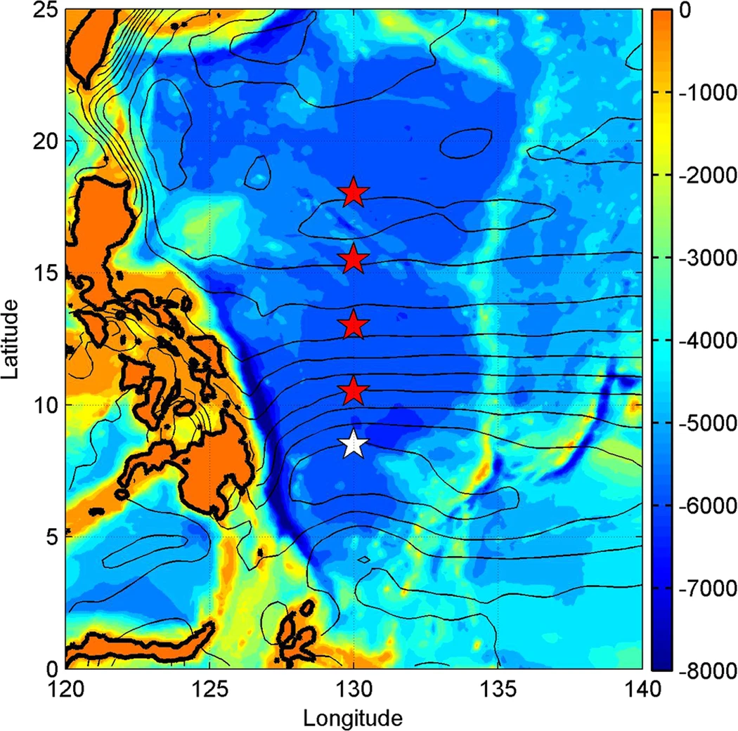
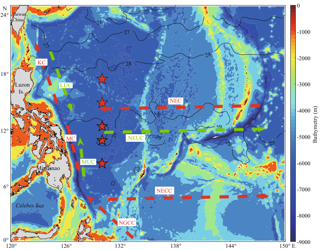
| 5 | 130°E, 8 to 17.5°N | 2014.09 to 2021.12 | Supplementary (Frontiers) | 4, 6, 7, 9 |
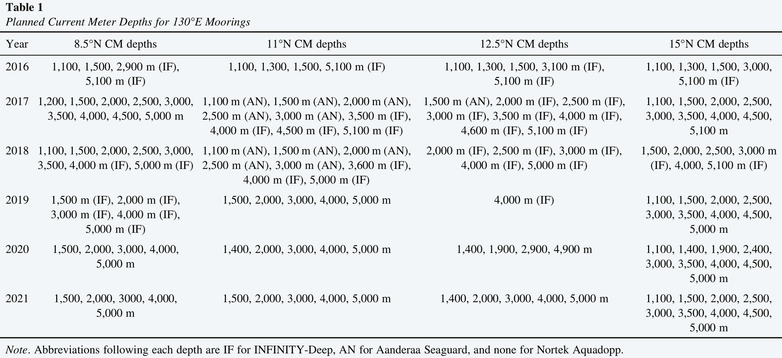
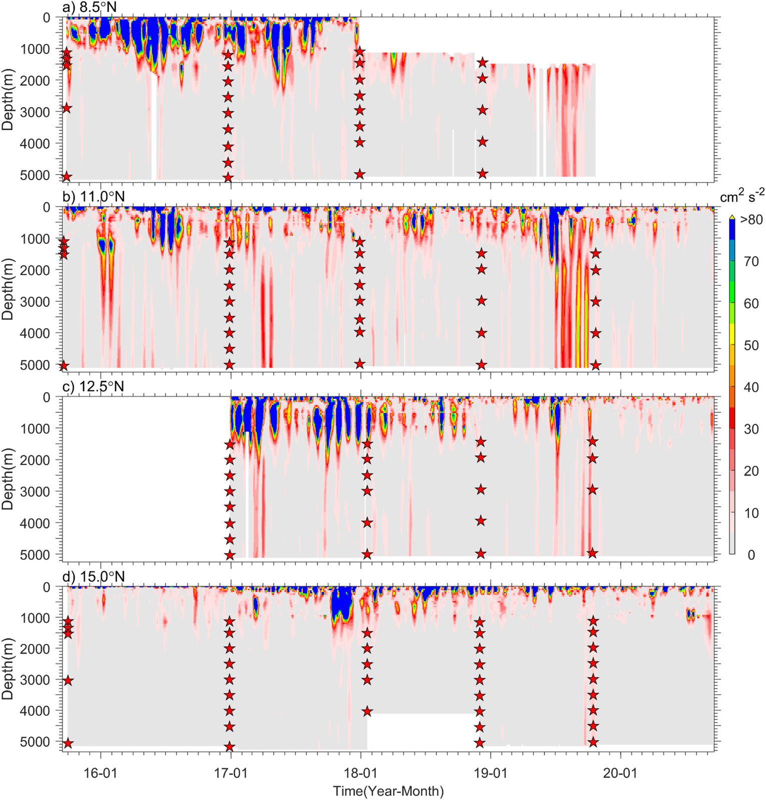
| 6 | 130°E, 8.5 to 15°N | 2016 to 2021 | Zenodo (current meter) · Paper (JGR) | 5, 7, 9 |
| 7 | 130°E, 11 to 17.5°N | 2017.10 to 2017.11 (Typhoon Lan) | CAS ODC · Paper (JGR) | 5, 6, 9 |
| 8 | M1 146°E 25°N, M2 122.67°E 22.3°N, M3 126°E 18°N | 2017.04 to 2020.12 | CAS ODC · Preprint (EGUsphere) | 1 (M1) |
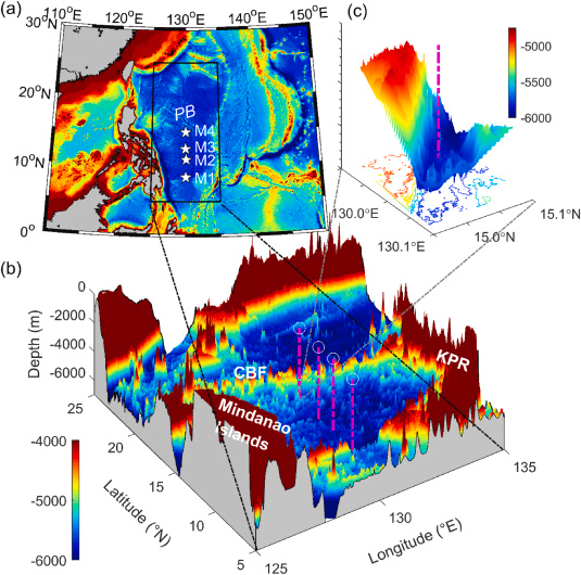
| 9 | 130°E, 8.5 to 15°N (M1 to M4) | 2015.09 to 2020.09 | Zenodo · Paper (JGR) | 5, 6, 7 |
| 10 | 128.0°E, 20.45°N (Northern Philippine Basin) | 2021.12 to 2025.05 | Zenodo · Paper (JGR Oceans, 2026) |
Details of moorings 1 to 10
1. 146°E, 25°N and 30°N (2017.08 to 2017.12). Subsurface mooring observations during Typhoon Sanvu in the western Pacific: near-inertial and sub-inertial velocities obtained by filtering after quality control. The JPO paper uses one of the two moorings and states that data are available on request, whereas the CAS ODC link provides both moorings for the typhoon period. The mooring in the JPO paper was deployed at 25°N, 146°E from April 2017 to June 2018.
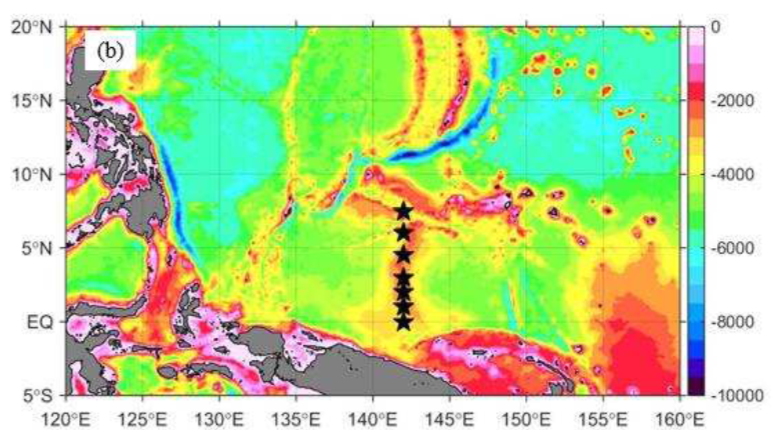
2. 142°E, 0 to 7.5°N (2014.08 to 2015.10). Seven subsurface moorings along 142°E at 0, 1, 2, 3, 4.5, 6 and 7.5°N. Each mooring carried one upward- and one downward-looking 75 kHz ADCP at a design depth of 400 m. U and V were interpolated to 10 m intervals between 60 and 650 m and averaged into daily means. Because two upward-looking ADCPs failed, no data are available for the upper 400 m at 3°N and 6°N. Subsurface structure and variability of the zonal currents in the Northwestern Tropical Pacific (DSR I) uses the same moorings but provides no data; they are available for research purposes on request to Fan Wang (fwang@qdio.ac.cn).
Supplementary data 2 (xlsx) Supplementary data 3 (xlsx)
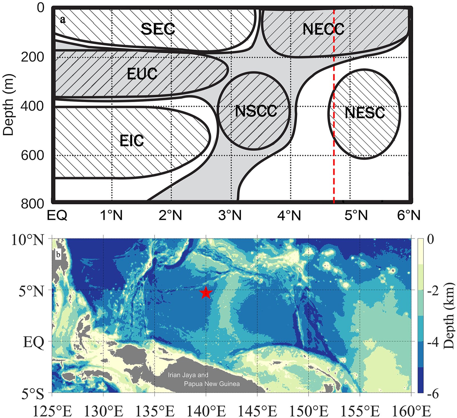
3. 140°E, 4.7°N (2014.01 to 2018.12). Part of the CAS Scientific Observing Network, water depth about 4,100 m, maintained through four recoveries and redeployments. Upward- and downward-looking 75 kHz TRDI ADCPs at about 500 m give hourly profiles over 50 to 1000 m in 8 m bins.
4. 130°E, 140°E, 142°E (2014.11 to 2015.06). Five moorings along 130°E, seven along 142°E, and three at (139.05°E, 11.58°N), (140°E, 4.7°N) and (140°E, 2°N). Data are for scientific research only. Model-based assessment of a Northwestern Tropical Pacific moored array (Ocean Modelling) describes the same array (the NWTPO mooring system established in 2013 under the WPOS project) but provides no data.

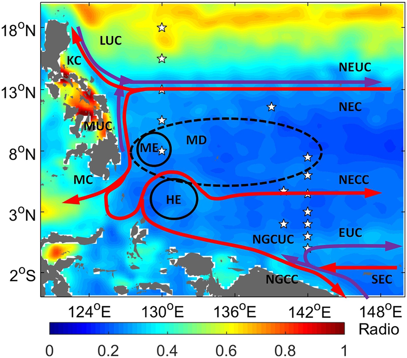
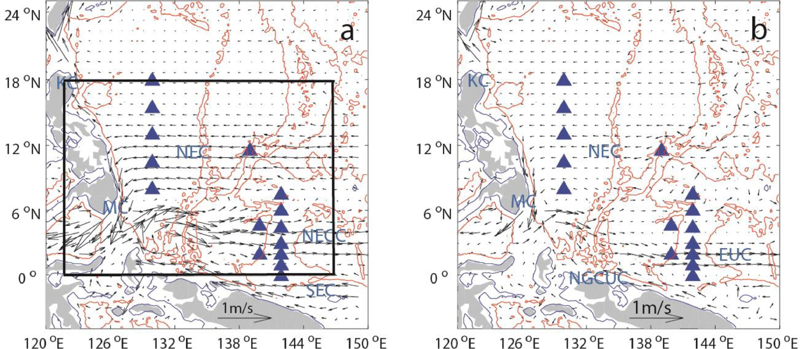
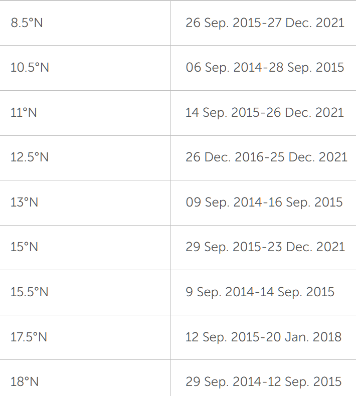
5. 130°E, 8 to 17.5°N (2014.09 to 2021.12). Five moorings deployed at 8, 10.5, 13, 15.5 and 18°N in September 2014, then moved to 8.5, 11, 12.5, 15 and 17.5°N in September 2015 to capture the NEUC jets better, and recovered every year since.
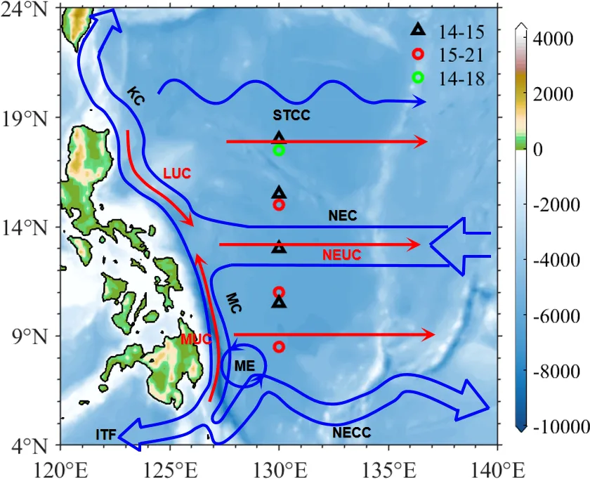
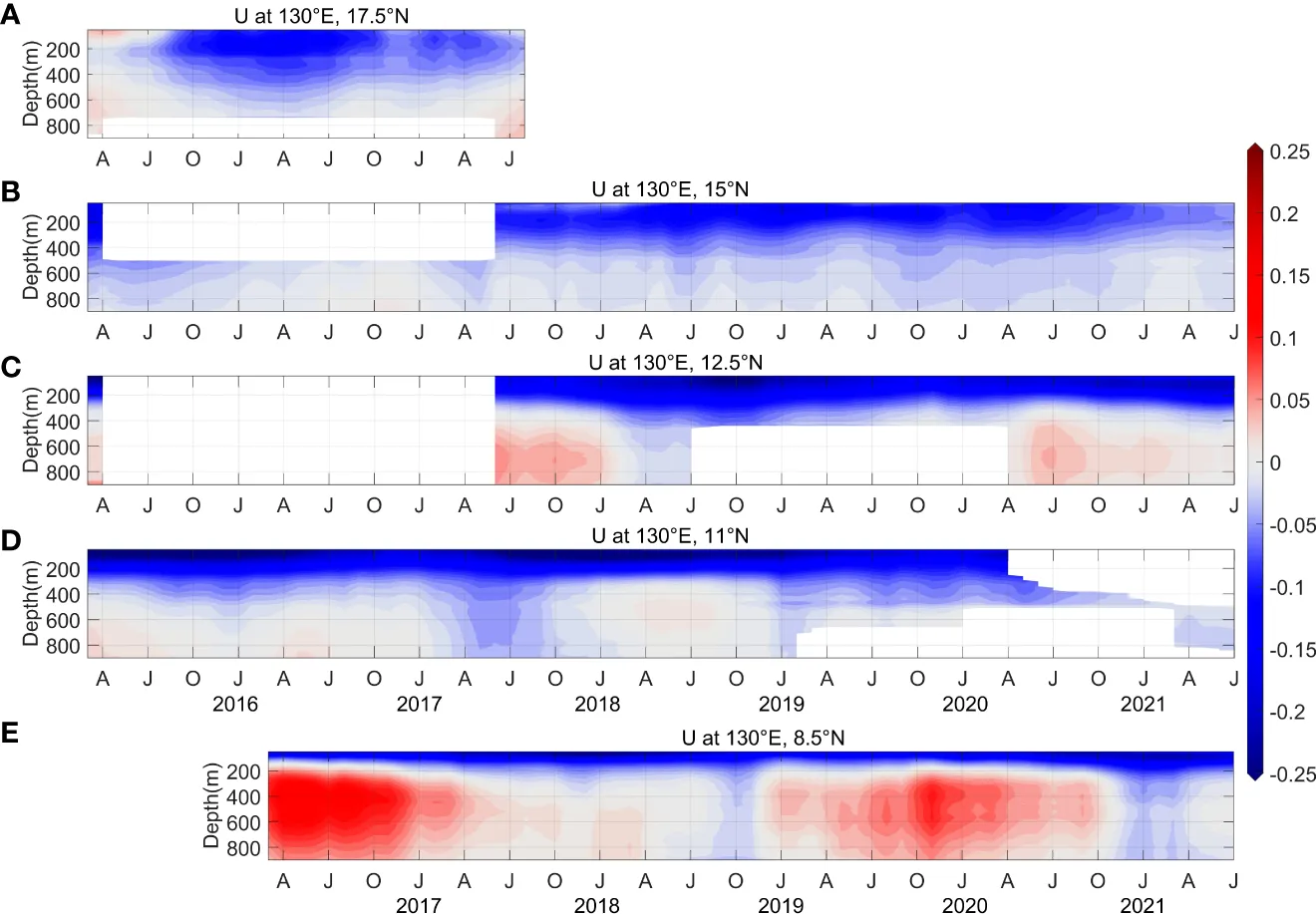
6. 130°E, 8.5 to 15°N (2016 to 2021). Current meter data are on Zenodo; the ADCP data are in the supporting information of Huang et al. (2022) (dataset 5).
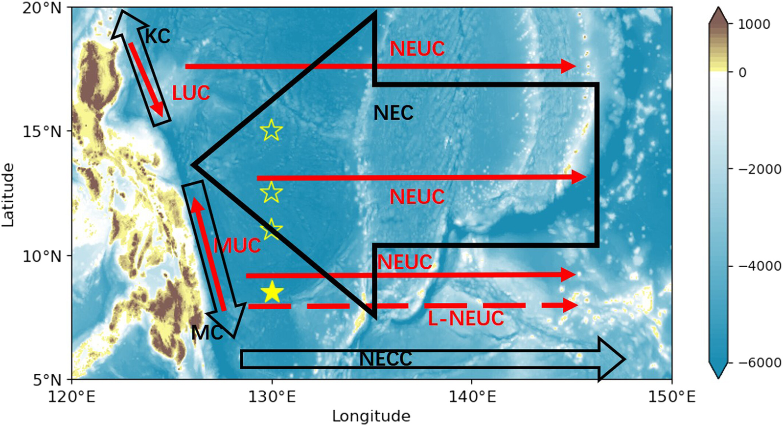
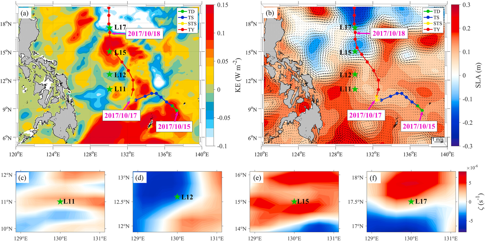
7. 130°E, 11 to 17.5°N. Four moorings (L11, L12, L15, L17) deployed from 1 August 2016 to 14 December 2017 under NPOCE, each with two 75 kHz ADCPs at 400 m. The study used 10 October to 5 November 2017, when Typhoon Lan passed over the array.
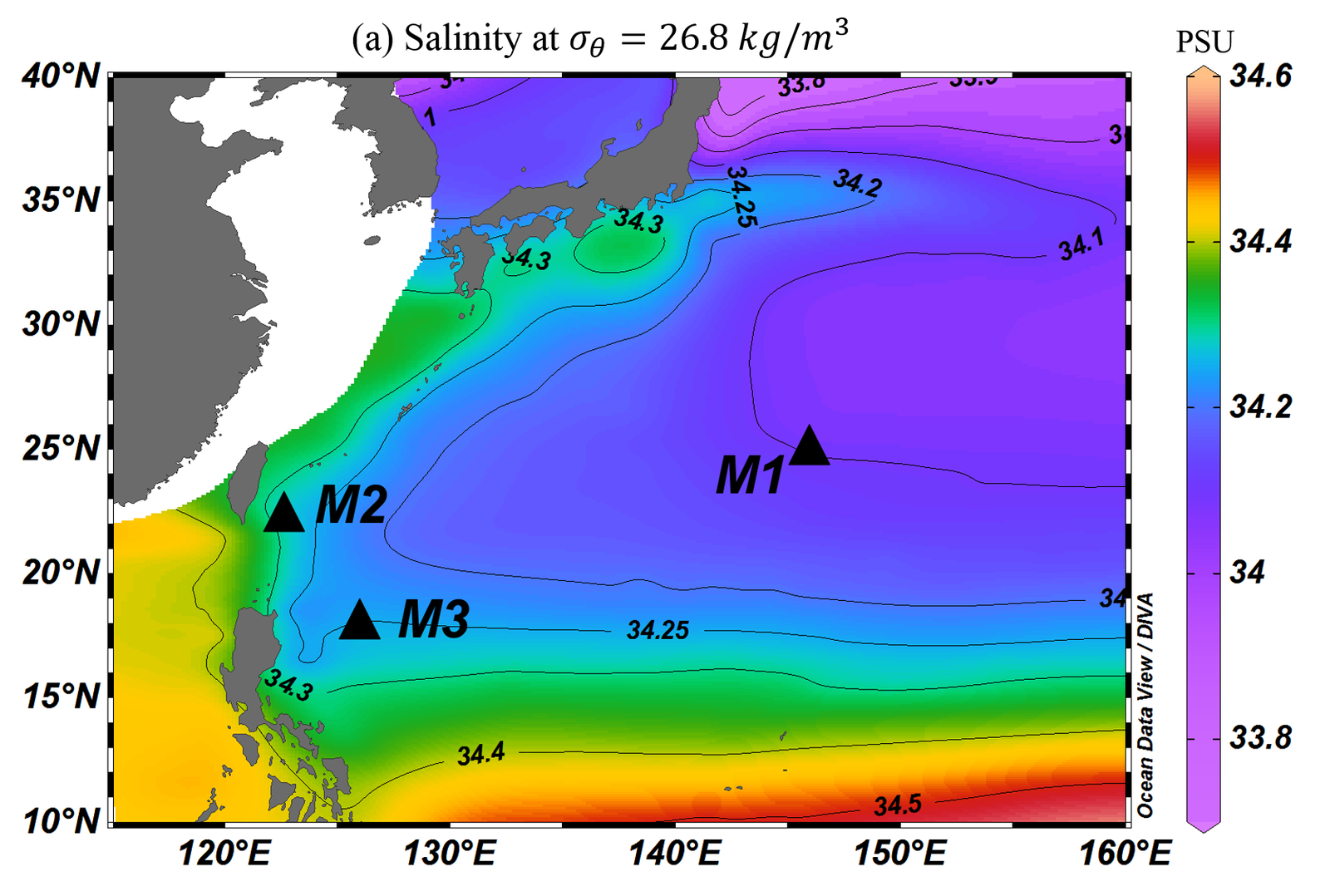
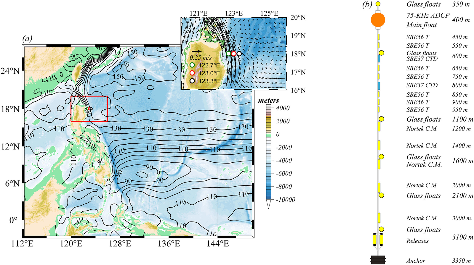
8. Intermediate-layer mooring data in the western Pacific (temperature, depth, salinity; 2017.04 to 2020.12). M1 = 146°E, 25°N (April 2017 to June 2018); M2 = 122.67°E, 22.3°N (August 2019 to December 2020); M3 = 126°E, 18°N (January 2016 to June 2017).
Mooring 8 data description (txt)
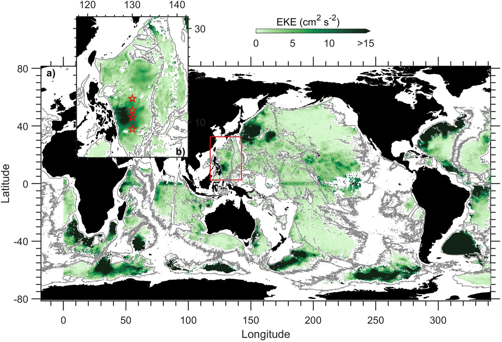
9. 130°E (2015.09 to 2020.09). CASSON moorings M1 to M4 at 8.5, 11.0, 12.5 and 15.0°N in the Southern Philippine Basin, water depths about 5,800 to 5,975 m, recovered and redeployed annually.
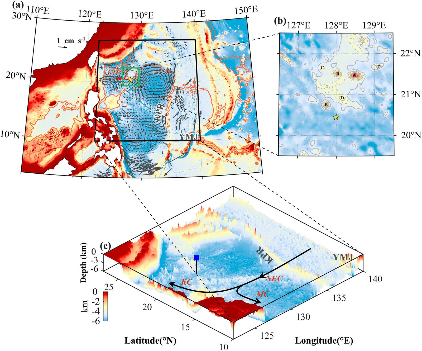
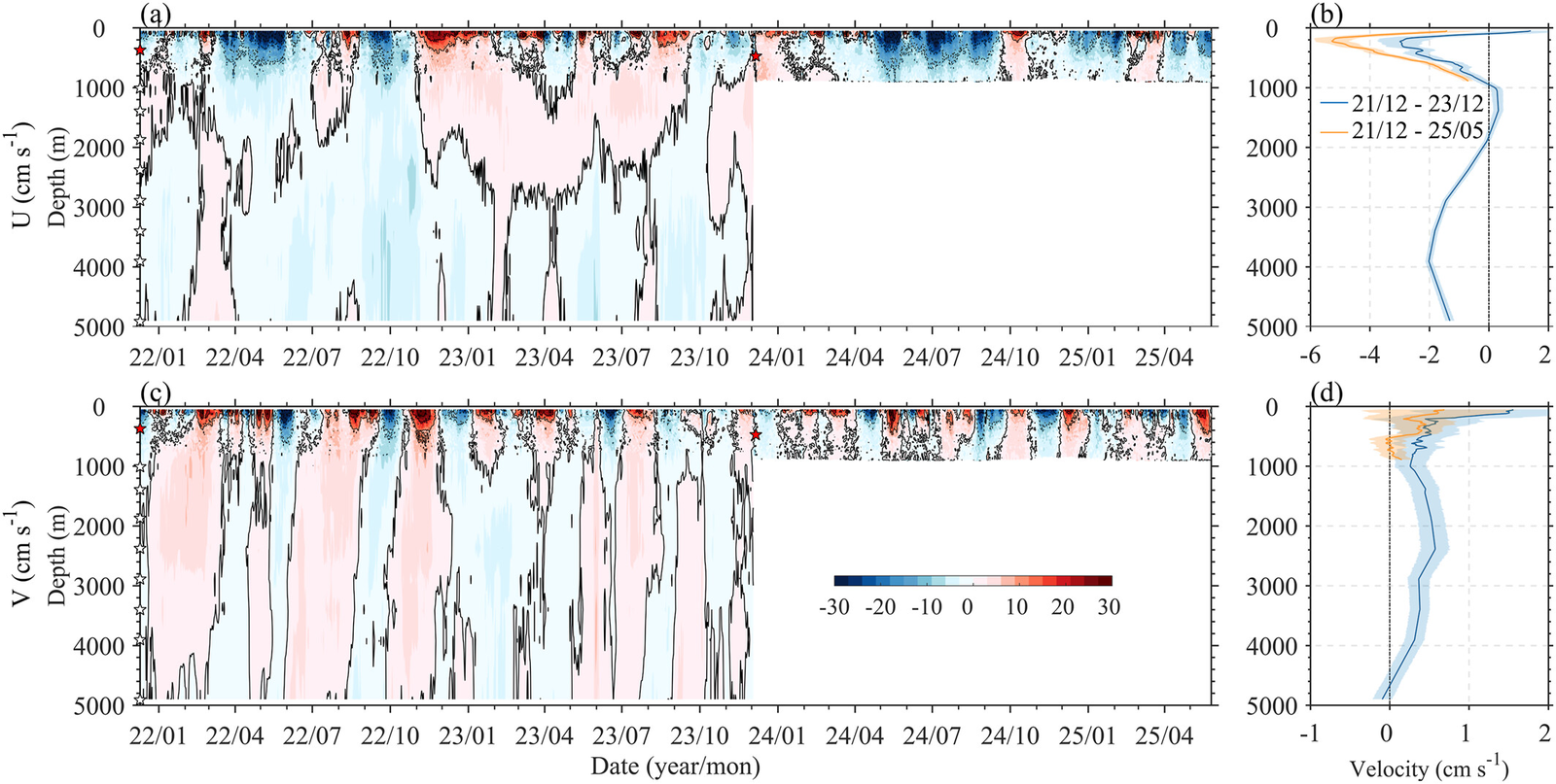
10. 128.0°E, 20.45°N (2021.12 to 2025.05). CASSON nearly full-depth mooring in the northern Philippine Basin, water depth about 5,200 m: deployed on 10 December 2021, recovered on 5 December 2023 and redeployed at the same site, with velocity records spanning the surface to about 4,900 m. Used in Ma et al. (2026, JGR Oceans) to show two bottom-intensified intraseasonal bands (about 83 and 113 days) consistent with topographic Rossby waves. Potential temperature and velocity data are on Zenodo (Ma, 2026); the record asks users to contact the author (Dr. Jie Ma, jma@qdio.ac.cn) before use.
Datasets that require registration or are not accessible
Registration required: NPOCE data access. NPOCE data access (accessible after registration; not yet tried)
- 2010 to 2012: ADCP at (18°N, 122.7°E)
ADCP_18N.nc, (8°N, 127.3°E)ADCP_8N.nc - 2015 to 2019: (1.7°S, 141.4°E)
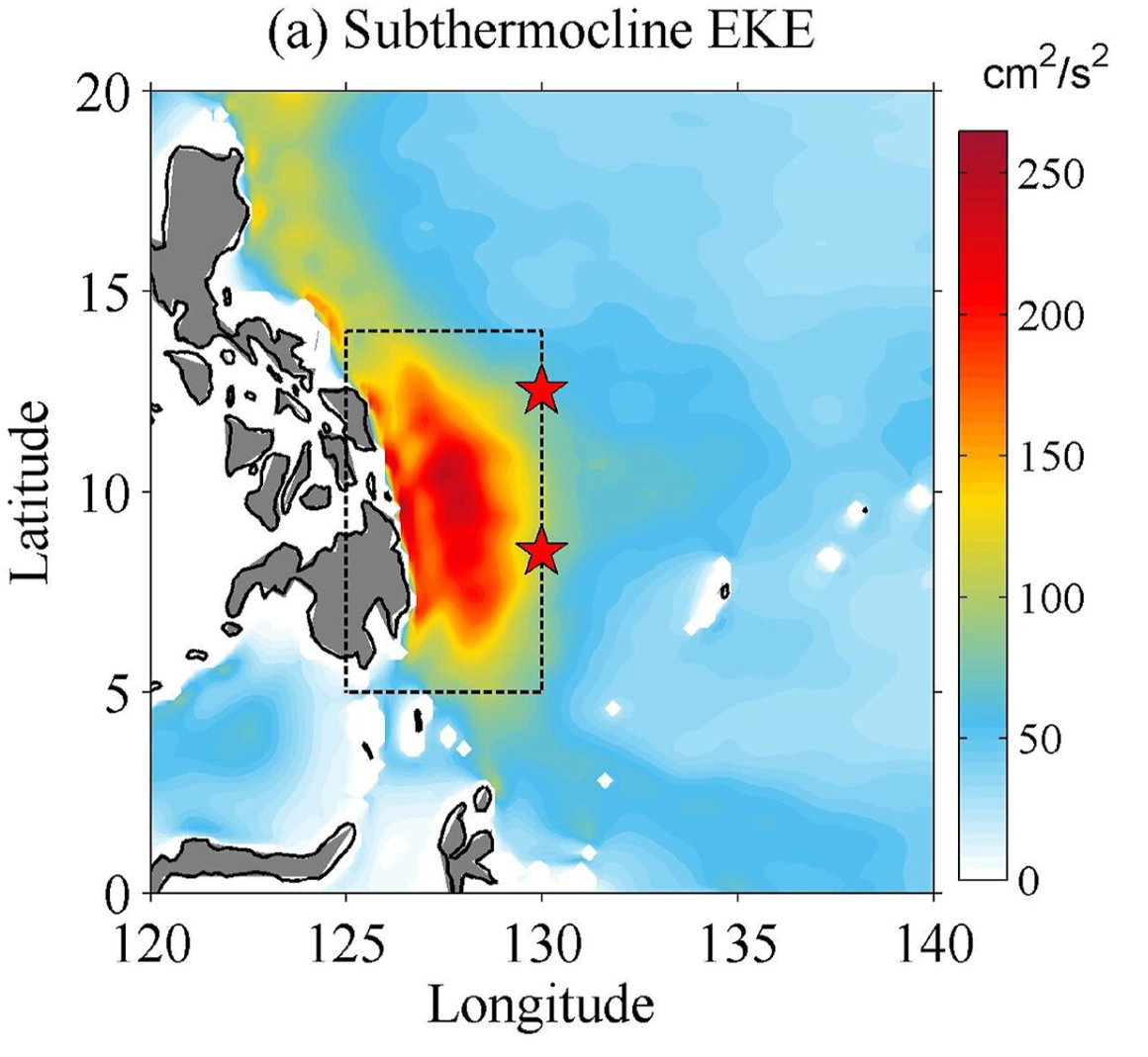
ADCP_1.7S141.4E.mat, (1°S, 141.7°E)ADCP_1S141.7E.mat, (8.5°N, 130°E)ADCP_8.5N130E.mat, (12.5°N, 130°E)ADCP_12.5N130E.mat - 130°E, 8.5°N (2015.09.26 to 2019.10.24) and 12.5°N (2016.12.26 to 2018.11.30): Interannual Modulation of Subthermocline EKE East of the Philippines (the address given in the paper, http://npoce.qdio.ac.cn/moored, is not accessible)
Bibliography (NPOCE moorings): Direct Measurements of the Luzon Undercurrent · Mindanao Current/Undercurrent measured by a subsurface mooring · Strengthening Kuroshio observed at its origin during November 2010 to October 2012 · Interannual Variability of the Mindanao Current/Undercurrent · Currents off the New Guinea Coast From Mooring Measurements
Not accessible
- 18°N east of Luzon (2018.01 to 2020.05, current velocity): Kuroshio and Luzon Undercurrent observed by a Mooring Array (JGR) · CAS ODC
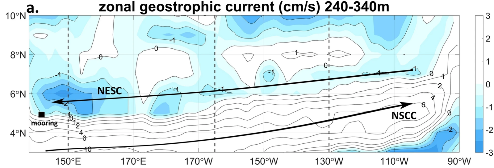
- 142°E, 4.7°N (2016.11 to 2017.10), near the NESC axis: Pacific North Equatorial Subsurface Current (Sci. Rep.) · https://itf.qdio.ac.cn/xzlxz/
- 140 to 142°E, 0 to 4.7°N (2014 to 2021), partly overlapping datasets 2, 3 and 4: Seasonality of intraseasonal variability in upper equatorial western Pacific currents (ERL) · Zenodo
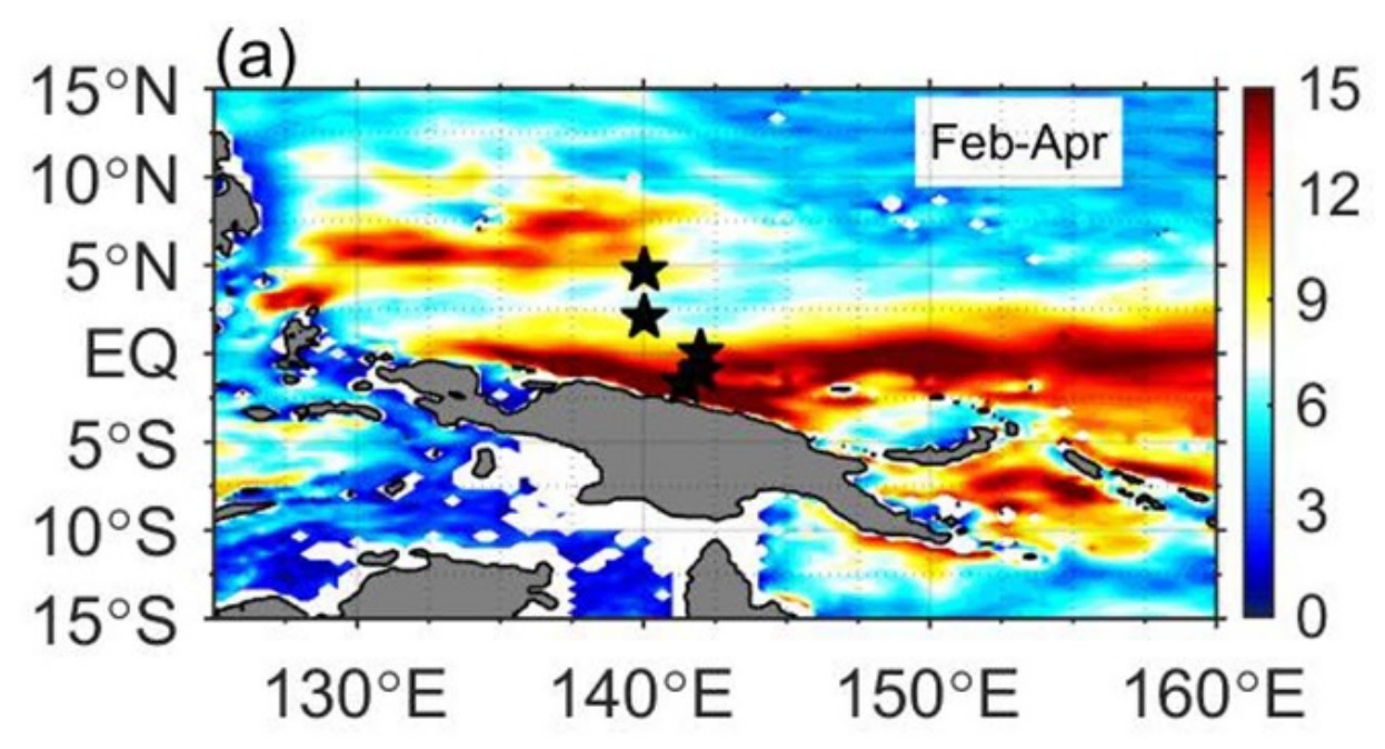
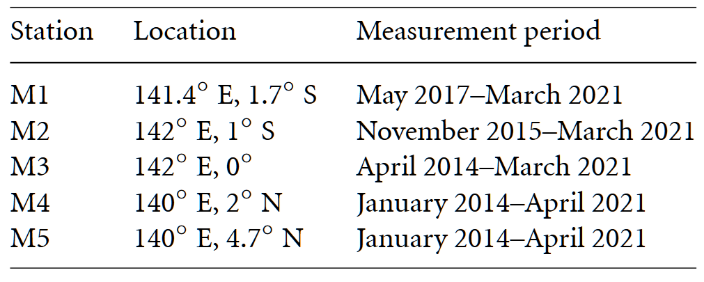
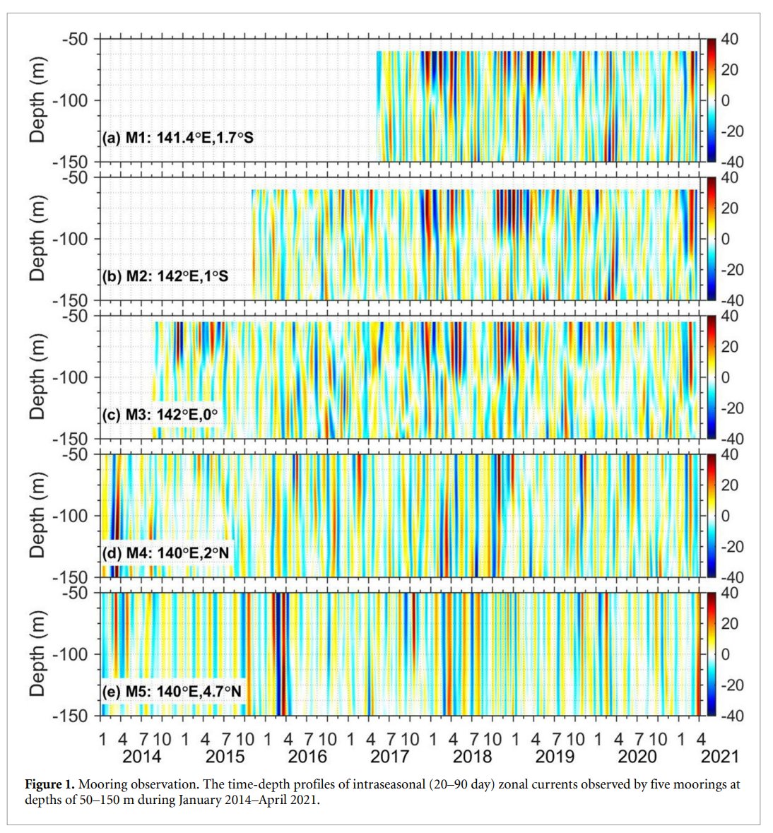
- 140°E, 2°N and 4.7°N (2014.01 to 2014.08), partly overlapping dataset 3 (same stations as dataset 4 but different period): Mooring observations of equatorial currents in the upper 1000 m (JGR) (available for research purposes on request to Fan Wang, fwang@qdio.ac.cn)
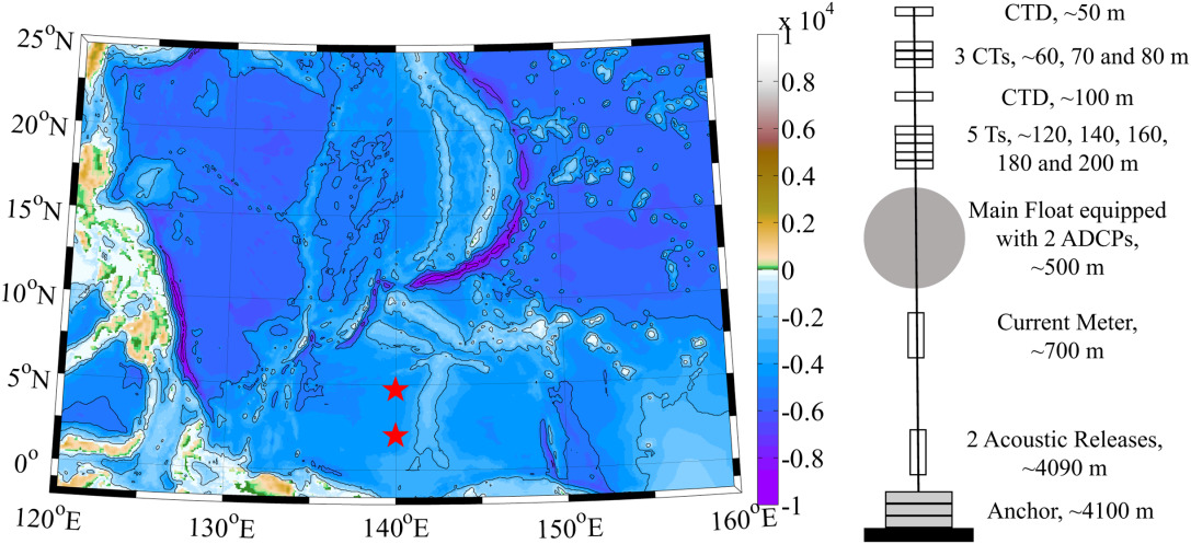
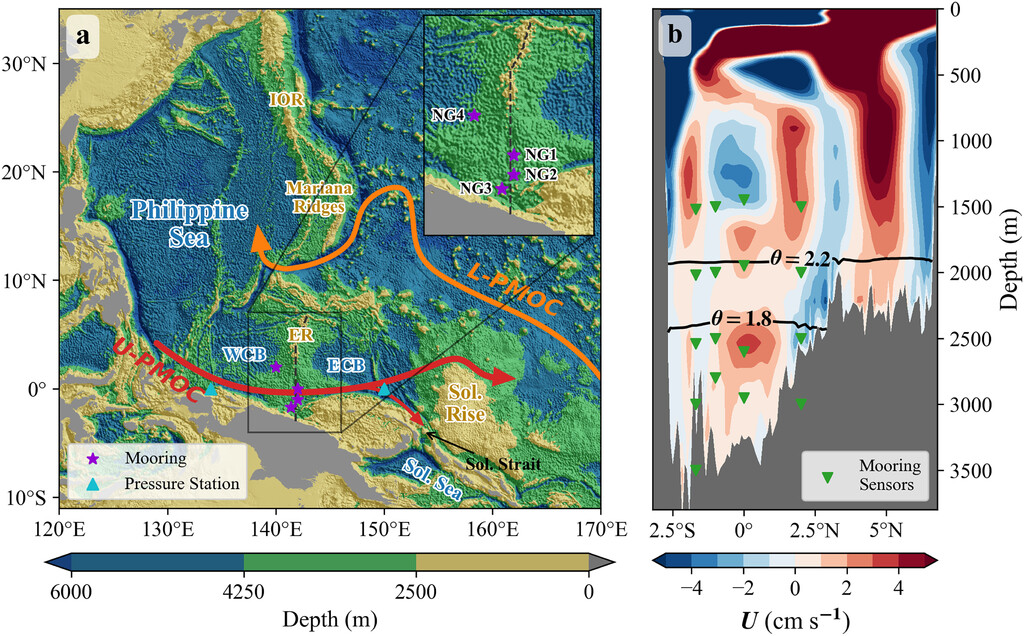
- 140 to 142°E, 0 to 2°N (2014 to 2019; NG1 0°, 142°E / NG2 1°S, 142°E / NG3 1.7°S, 141.4°E / NG4 2°N, 140°E), partly overlapping datasets 2 and 4: Upper Deep Branch of the Pacific MOC North of New Guinea (JPO) · Zenodo
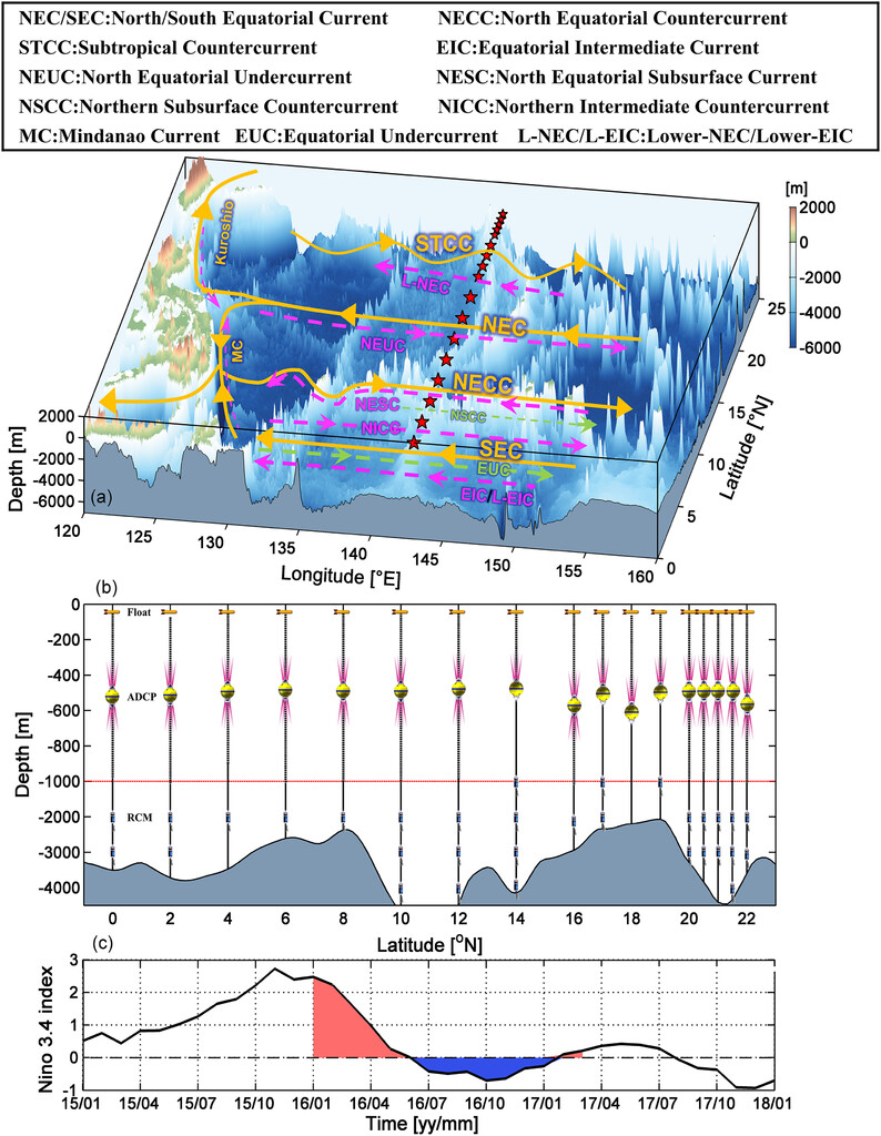
- 143°E, 0 to 22°N (2015.11 to 2017.03, 17 moorings; spacing 2°, 1° and 0.5° over 0 to 16°N, 16 to 20°N and 20 to 22°N): Full-Depth Zonal Currents along 143°E (JPO) (contact the corresponding author)
Papers that used the 130°E line but provide no separate data (see datasets 4 to 7)
- Structure and Variability of the NEC/NEUC from Mooring Measurements at 130°E (Sci. Rep.) (2014.09 to 2015.09; the 8.5°N mooring was lost)
- NEC/NEUC volume transport and its 40-day variability along 130°E (J. Oceanol. Limnol.) (2016.12 to 2017.12)
- Deep currents in the Southern Philippine Basin (DSR I) (2015.09 to 2020.09)
Taiwan
-
ODB (國科會海洋學門資料庫) · 1/4°, 1985 to present
Gridded means and standard deviations of temperature, salinity and other variables at standard depths around Taiwan (105 to 135°E, 10 to 35°N).
How the ODB gridded product is made
Data collection has increased since 1985, and the downloadable products are statistics over various periods from 1985 to the present. All depth profiles (temperature, salinity and others) are first interpolated to standard depths by latitude and longitude, then binned onto a 15' × 15' (1/4° × 1/4°) grid, and the mean and standard deviation of each hydrographic variable are computed for each cell. A cell needs at least three records of temperature and salinity to enter the statistics.