Japan Oceanographic Database [2025.03.03]
일본 기관(JMA, JODC, JAMSTEC, FRA 등)이 제공하는 관측·모델 자료입니다.
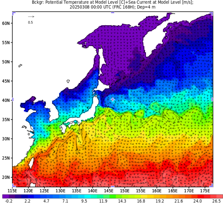
수치 모형
JODC (Japan Oceanographic Data Center)
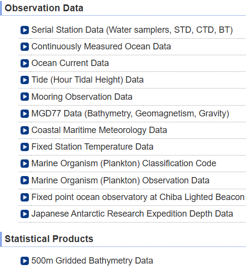
JODC data
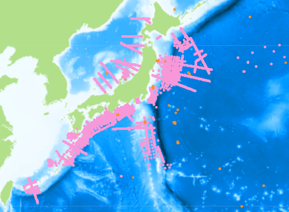
해양 조사 자료, 항주 연속 관측, 계류, 해류, 연안 해상기상, 정점 수온, 플랑크톤, 조위, 500 m 격자 수심
JODC 자료 종류별 정리
J-DOSS (JODC Data On-line Service System)
JMA (Japan Meteorological Agency)
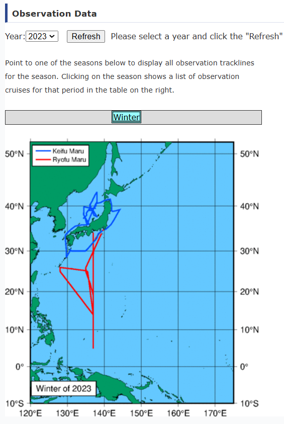
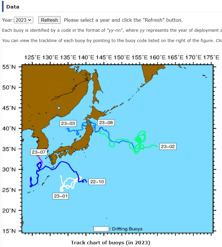
연구선 관측 자료
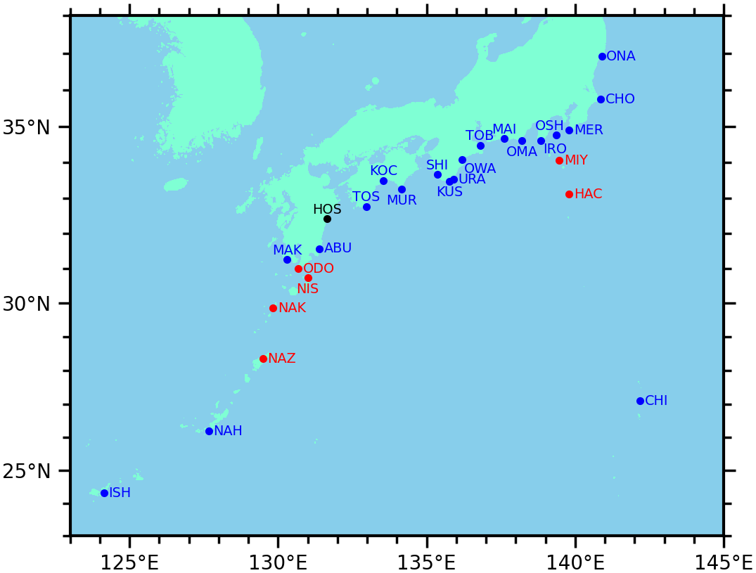
1997~2023
Oceanographic and Marine Meteorological Observations by Research Vessels. txt 등의 형식으로 제공되며, 관측 방식마다 포맷이 정해져 있으니 사이트에서 원하는 포맷을 찾아 참조하세요.
포맷 예시: JMA subsurface current 자료 (PDF)
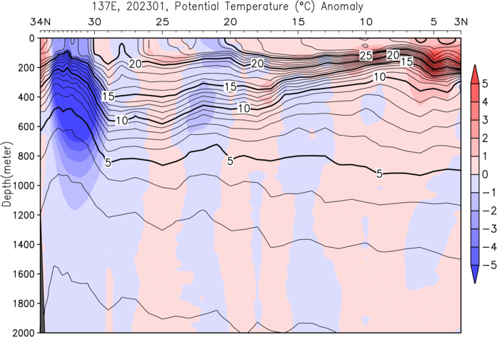
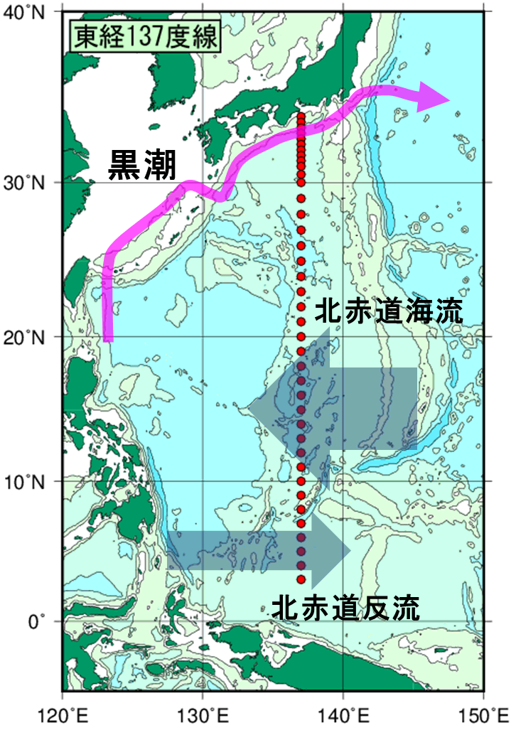
137°E 자오선 단면 시계열
Oceanographic Section Time-series Dataset for the 137°E Meridian
State of the ocean climate
JAMSTEC
JAMSTEC 자료 검색 포털 · GODAC 자료 카탈로그
연구선 관측 데이터베이스
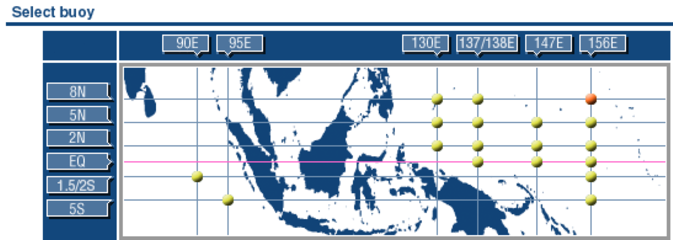
Subsurface ADCP mooring (TOCS)
서태평양과 동인도양의 ADCP 계류. hourly mean, 10 m bin
JAMSTEC ADCP 자료
NASA Earthdata 등록 정보
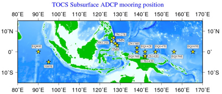
TOCS ADCP mooring 상세
As the "TOCS (Tropical Ocean Climate Study)" project in JAMSTEC, variability of long-term surface and subsurface ocean current have been observed by the ADCP (Acoustic Doppler Current Profiler) mooring system in the western Pacific Ocean and in the eastern Indian Ocean. The ADCP used in this project is the RDI 150 kHz Broad-Band type for the western Pacific Ocean area, and the RDI 75 kHz Work Horse type for the eastern Indian Ocean area. After removing electric noise, the data were processed to the hourly mean and 10 meters depth bin.
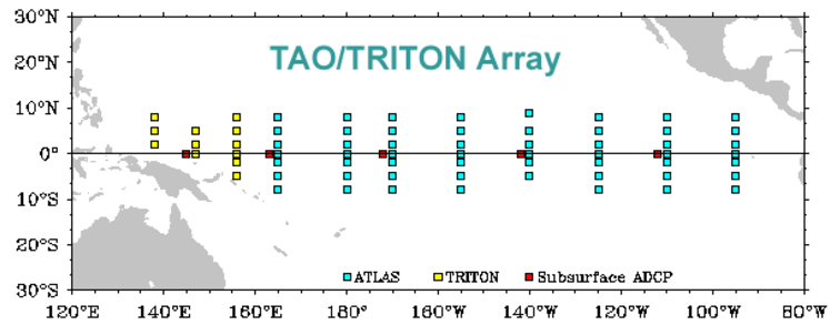
TRITON
TAO/TRITON array 중 일본이 TRITON을 담당합니다.
TRITON 실시간 표출
TAO/TRITON Data Display and Delivery (PMEL)
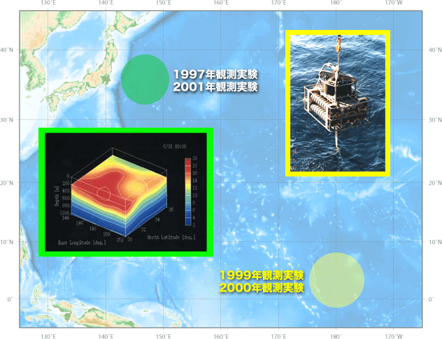
해양 음향 토모그래피
1997~2001
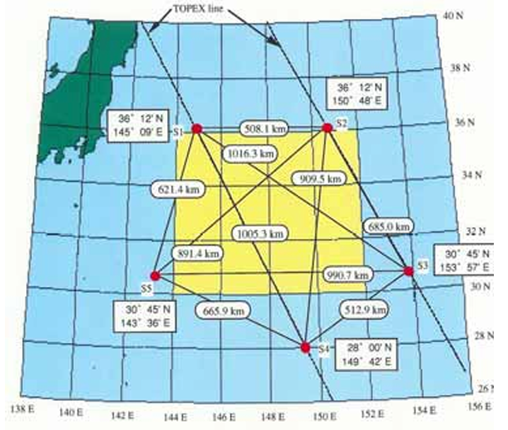
Kuroshio Extension과 중앙 적도 태평양의 해양 음향 토모그래피 실험. 자료 이용은 dmo@jamstec.go.jp로 문의하세요.
설명 문서 압축 파일 (zip, 관측 자료는 포함되지 않음)
음향 토모그래피 자료 상세
JAMSTEC conducted ocean acoustic tomography experiments from 1997 to 2001 in the Kuroshio Extension region and central equatorial Pacific.
For details, refer to /ACOUSTIC_TOMOGRAPHY/index.html (Japanese only) after extracting ACOUSTIC_TOMOGRAPHY.zip.
The zip file contains no observation data. If you wish to use the data, please contact dmo@jamstec.go.jp.
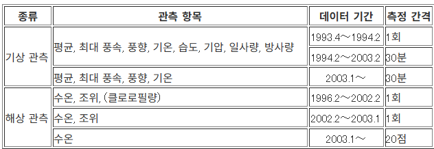
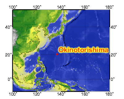
오키노토리시마 관측
1993~
오키노토리시마의 기상·해양 관측 자료. 매년 4월경 최신 자료가 추가됩니다.
JAMSTEC Okinotorishima
GODAC metadata
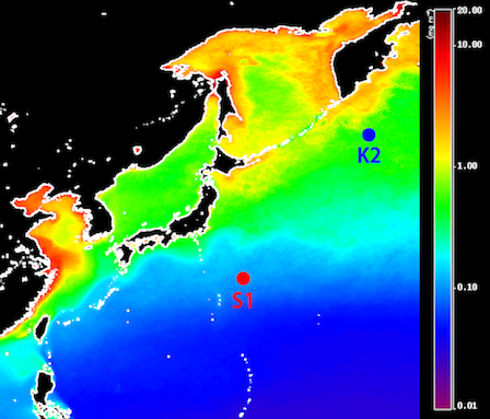
시계열 정점 K2, S1
K2: 47°N, 160°E (서부 아한대 순환), S1: 30°N, 145°E (아열대 순환). 2010년부터 R/V Mirai로 비교 시계열 관측
K2/S1 database
GODAC metadata (KNOT K2)
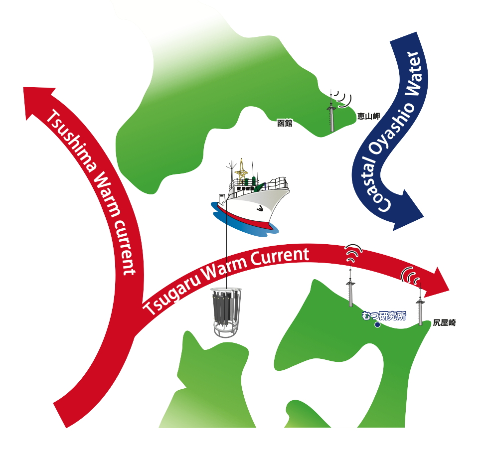
쓰가루 해협 선박 시계열
쓰가루 해협 횡단 CTD와 채수 (염분, DO, 영양염, DIC, TA, 18O, Chl-a). CTD 자료는 홋카이도대학, 채수 자료는 JAMSTEC 소유
Fisheries Research Agency (FRA)
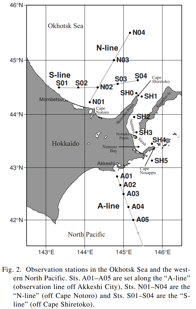
N-line
홋카이도 앞 Okhotsk 해역의 반복 관측선. CTD, 영양염·Chl-a, 플랑크톤 자료
기타 자료
Japanese SOOP data
Database of Climate Change Observation (NIES)
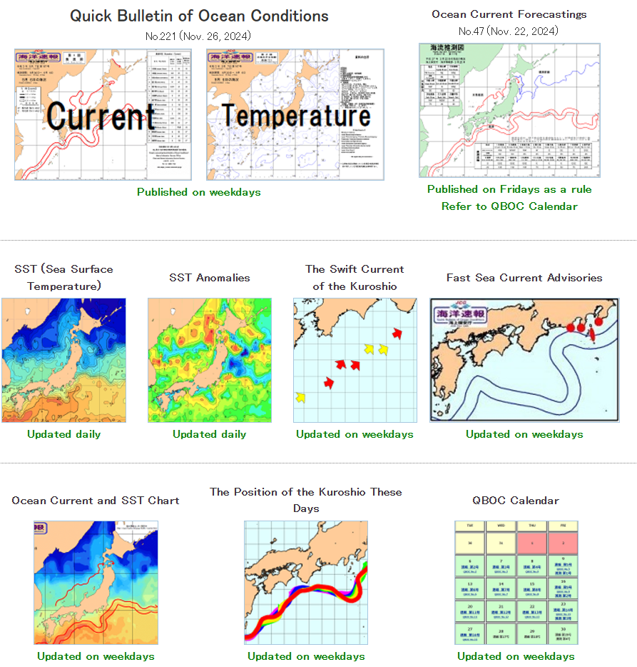
해양 관련 다양한 자료를 모아 둔 사이트입니다. 이 페이지를 구성할 때 참고했습니다.
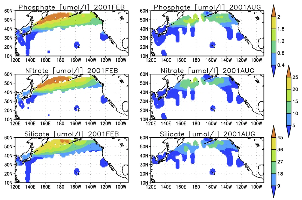
Michitaka Uda 논문 목록
한반도 주변 해류 연구에 자주 인용되는 Uda (1934)
- Uda, M., The results of simultaneous oceanographical investigations in the Japan Sea and its adjacent waters in May and June 1932 (in Japanese), J. Imperial Fish. Exp. Stn., 5, 138-190, 1934. 위 문서가 한반도 주변 해역의 해류 시스템과 관련하여 자주 인용됩니다. 아래 링크가 같은 문서로 추정됩니다(일본어). 035.pdf
- Hydrographical studies based on simultaneous oceanographical survey made in the Japan Sea and its adjacent waters during May and June, 1932 (영어). Rec. Oceanogr. Wks. Japan, 6(1), 19-107, 1934.